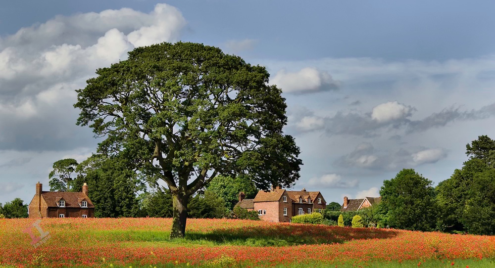
This was taken back in 2009 at a small village called Donnington, near Wroxeter, between Telford and Shrewsbury (and not to be confused with the much larger town of the same name in Telford itself). I can’t remember now whether I knew that this poppy field existed beforehand, or if I came across it by accident, but I can remember trudging around the perimeter of the field with my tripod, trying to find the best composition.
I actually thought at the time that this had naturally occurred, but over the years since, I have never seen another poppy in this field, and so I assume that they had been grown commercially. This explains the poppy-free circle around the tree – presumably they didn’t sow any seeds near the tree because it would take all the nutrients and water from the soil?
Anyway, the red, green and blue are strong primary colours, and so for this reason the photograph stays in my long-term gallery.
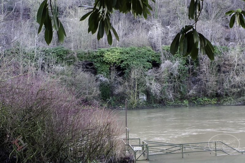
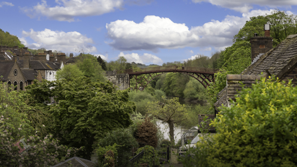
As the Great Western Railway passes Bowers Yard and heads towards the site of the old power station, it runs very close to the River Severn, and so the Victorian engineers decided that the best solution was to build a viaduct parallel with the river.
A viaduct is a specific type of bridge that consists of a series of arches, piers or columns supporting a long elevated railway or road, typically connecting two points of roughly equal elevation. Contrary to popular belief, if doesn’t necessarily have to be crossing over water. Such is the case here; the viaduct merely elevates the railway above the banks of the river, it doesn’t actually cross it at any point.
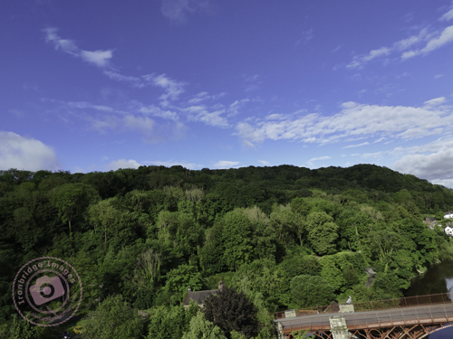
It is easy to miss another great feat of Victorian engineering; although you can still traverse the viaduct by foot, the base of it has become surrounded by trees, and ivy clings to the brickwork. Fortunately, my drone was able to fly over the river and catch some shots that otherwise would remain unseen.
There has been some recognition of the viaduct and a lot of ivy has been removed since my shot taken in 2013:
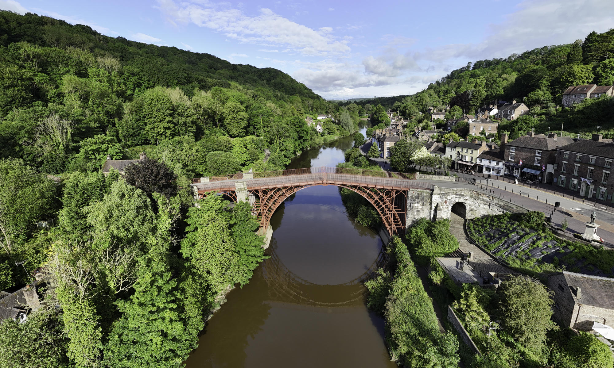
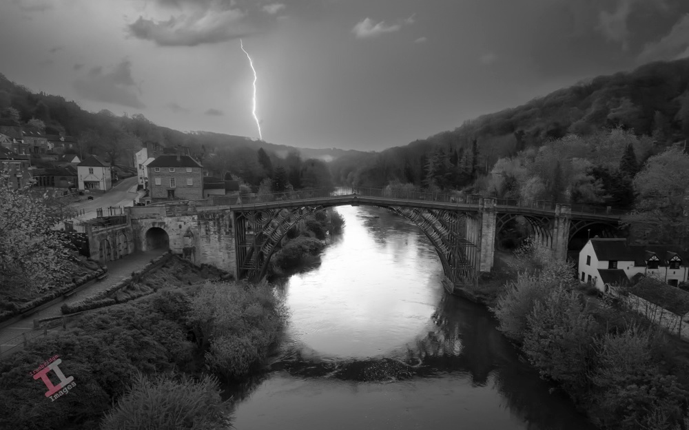
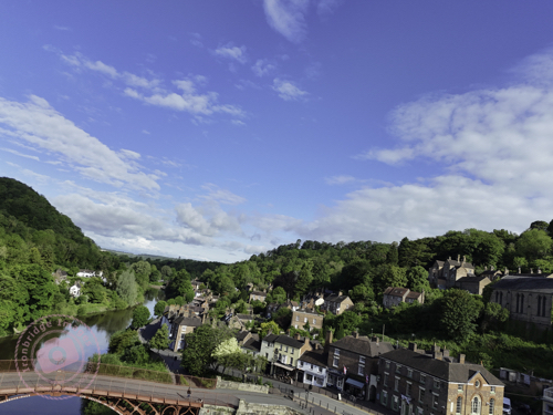
This image encompasses two of my current projects: it is a day-to-night conversion (including a sky replacement) and a black-and-white conversion. It was taken with my drone, early one morning before the town had started to come to life and post-processed with Adobe Lightroom and Photoshop.
Yesterday I managed to complete another task off my to-do list; and took a photograph in order to create new headers for my website and Facebook page. The dimensions for both are quite specific (and different to each other) and it required a wide-angle shot so that it could be cropped quite heavily to suit the size and aspect.
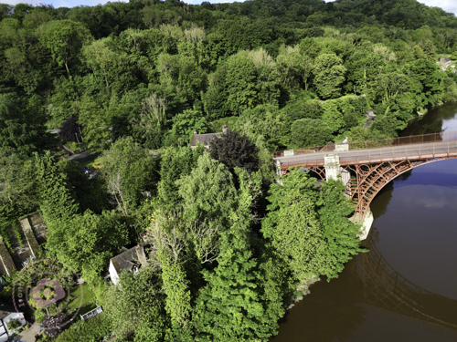
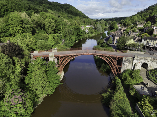
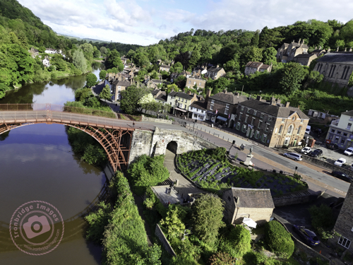
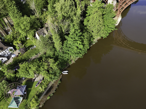
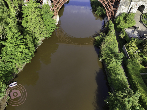
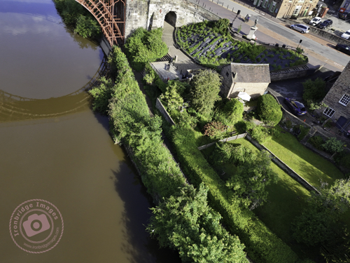
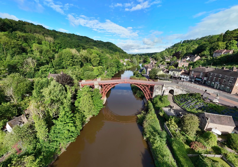
I wanted an aerial shot of the Iron Bridge, and so this either meant taking it from a long way off (and then losing detail) or using the panorama function of my DJI Mini 4 Pro drone – the latter turning out to be the ideal choice.
Even though it was 8.30am on a Bank Holiday, it was surprisingly quiet and deserted, and therefore ideal to fly the drone from a seating area directly in front of the bridge. There are four panorama options on the drone; Sphere, 180o, wide-angle, and vertical, but my preferred one, that produces a more natural image without too much stretching of perspective, is the wide-angle – which takes 9 shots in succession and seamlessly stitches them together (within the drones software) to create one large image. You can then output not only the large panorama image, but also the 9 individual shots.
And here is the complete panorama, which I later cropped to produce the headers for my website and Facebook page:
Iron Bridge Panorama
Please don’t forget to visit my new Facebook page and give it a ‘like’. Thanks
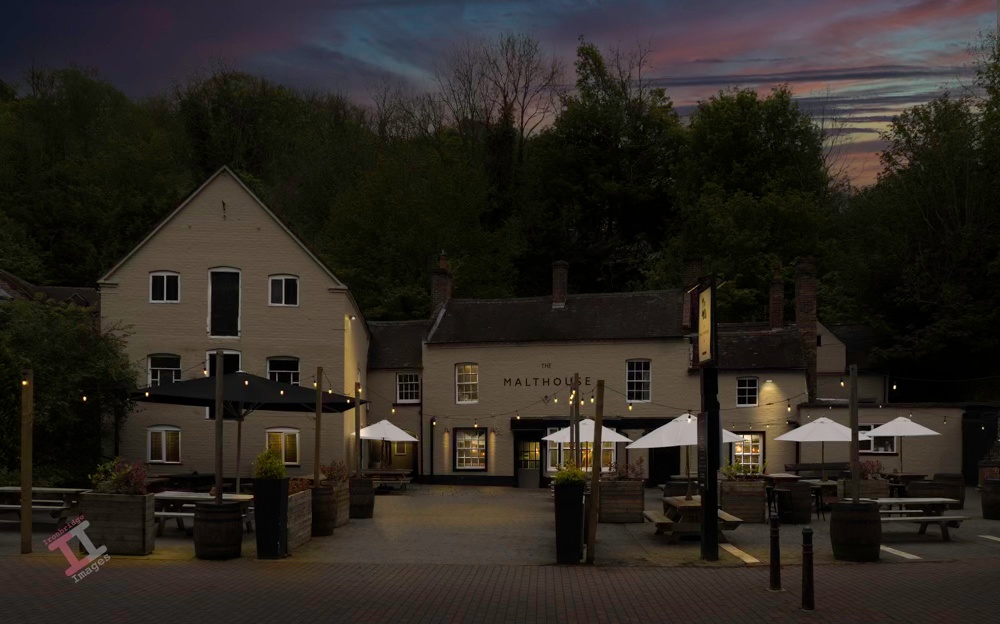
In my late teenage years, this was definitely “the place to be” on a Friday and Saturday night for those of us living in the Ironbridge Gorge, probably due to its late-night disco in the upstairs function room.
It was built in 1854, and the large warehouse-type building to the left was indeed, probably a malt house, although the inn was originally called The Talbot (it was still identified as such on the 1925 Ordinance Survey map).
There was a bit of a scare in July 2023 when a freak fire, caused by water leaking into a fusebox, looked as if it may engulf the building. Fortunately the blaze was extinguished before it damaged the structure of the building, but smoke damage meant that it had to shut down for a period. It is now open again.
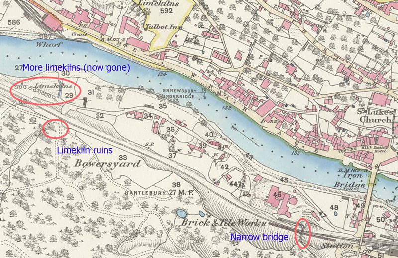
Despite being a lesser-known area of Ironbridge, Bower Yard had quite a significant importance: in its history it was the location of a brick & tile works, a ship yard and also substantial lime kilns, some remains of which can still be seen today.
The Iron Bridge from Bower Yard
Note: I have used the modern name Bower Yard, although old maps ofter refer to it as Bowers Yard or even Bowersyard.
Bricks and tiles
Slightly west of the site of Broseley and Iron Bridge Station, and the famous Iron Bridge itself, the Great Western Railway passed under another brick bridge – unusual in that, despite it being a substantial construction, it is very narrow. Analysis of a map from 1883 shows the reason why – it was built solely to carry a small tramway carrying clay from Benthall Edge to the Bower Yard White Brickworks, which lay between the railway line and the river. During its 120 year life, there were several name changes as the site migrated into manufacturing sanitary pipes and stoneware, but it finally closed in 1955.
Ship building
Little is known about the ship building yard, although it must have been a fair size given that there are records of a boat named ‘Sisters’ built at the yard in 1819 which had two masts, weighed 33 tons and was 54 feet (17m) in length, and another named ‘William’, built in 1809, which weighed 70 tons and was 66 feet (20M) in length. Both were subsequently registered at Chepstow, much further down the River Severn, at its estuary with the Bristol Channel.
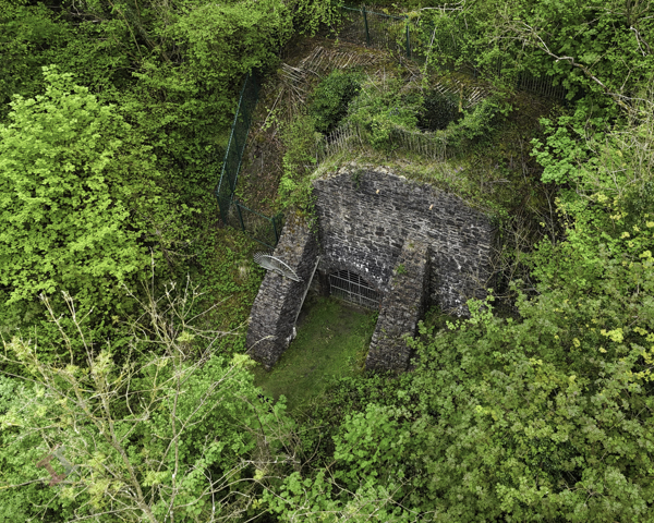
Lime kilns
The Pattens Rock limestone quarries at nearby Benthall Edge supplied flux for use in the iron smelting industries in the Ironbridge Gorge. This flux was used to remove impurities from the iron stone during the smelting process and required the use of the higher quality limestone. The lower quality limestone was sent to kilns at Bower Yard, which processed it into quicklime, used in construction for mortar, plaster and lime wash, but also in agriculture to reduce the acidity of soil (lime is very alkaline). The kilns purpose was to burn the limestone (calcium carbonate) at about 900 degrees Centigrade to produce calcium oxide (quicklime). This took about 3 days, plus the time to cool the kiln down to extract the lime. The burning of lime gave off particularly noxious fumes which would have made the area a particularly unattractive place.
Lime kiln ruins
The kilns were built during the mid 1800s but their use quickly declined and they ceased to be used by about 1880. Strangely, there was a revival in the 1920s as the demand for limestone increased and they sprung back into life, with significant improvements to their structure, until they closed again in the 1940s. The Great Western Railway played a big part in the success of the lime kilns, bringing coal to them for fuel and lime out of them for sale. There are numerous claims that a railway siding was built specifically for the lime kilns but I can find no evidence on any maps that this was the case.
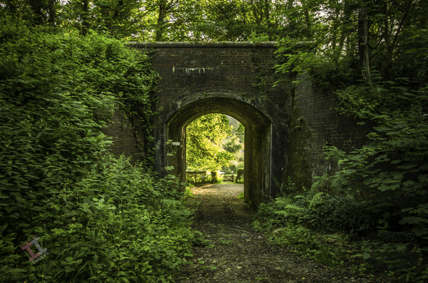
Also still surviving is the access bridge to the kilns under the Great Western Railway. It’s a narrow bridge, presumably just wide enough for a horse-drawn wagon but the northern flanks are impressively wide and high in order to retain the earth supporting the railway.
In 2011 there was conservation work carried out on the decayed ruins of lime kilns on the Benthall Edge side of the railway, although according to the 1882 OS map, a much more substantial set of lime kilns were located between the railway and the river, opposite the Severn Warehouse.
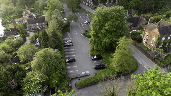
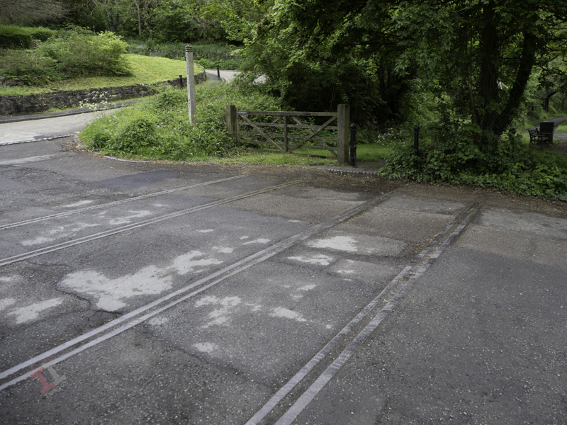
If you visit Ironbridge by car, you may well follow the signs to Ironbridge Central car park and wonder why it has that name, given that it really isn’t ‘central’ to anything.
This was a name dreamt up by the illustrious Telford & Wrekin Council, but the car park is still known by locals as ‘Station Yard car park’. Why? Because it is on the site of a long-gone railway station on the Great Western Railway (GWR) line.
This entire car park was once a bustling railway station
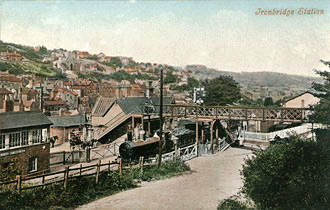
It was named Broseley and Iron Bridge station on the basis that, at the time it was built in 1862, the majority of the stations passengers came from nearby Broseley, which had a much larger population than around the bridge. During its life the name changed several times (perhaps by grammatical pedants) and was called:
Ironbridge and Broseley
Iron Bridge and Broseley
Iron-Bridge and Broseley
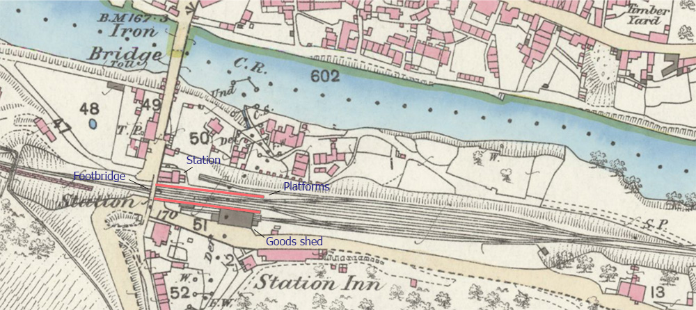
Apart from the single-storey station building adjacent to the bridge, there were two platforms, a a lattice footbridge connecting them, a substantial signal box, numerous sidings and a goods shed. There was also a level crossing (the remains of the track can still be seen) controlling traffic crossing the bridge.
The only remains – railway tracks crossing the bridge approach
A popular postcard of the time shows the signal box, footbridge and level crossing gates.
A map of 1883 shows that, just 20 years after it opened, the station yard was a busy place and subsequent maps show that the layout remained largely unchanged throughout its 101 years life.
The rise in popularity of the motor car (and road transport in general) meant that the railways went into decline after the Second World War and eventually the line closed in 1963. Many blame the infamous Beeching Report for the lines closure but, in reality, its future had already been decided due to lack of use.
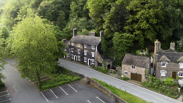
Overlooking the Station Yard is the aptly-name Station Hotel (now a restaurant called D’arcy’s at the Station), an imposing Grade II-listed, blue-brick, three-storey building originating at the same time as the railway.
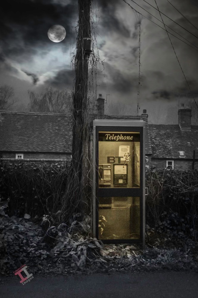
The public telephone box in Coalport, in the Ironbridge Gorge, shortly before it was removed in 2020. This ‘modern’ version had previously replaced a traditional red telephone box, one in which I made many calls before my parents had a telephone line installed (yes, there was life before mobile phones). I can even remember the original public telephone that used pre-decimal coins, and had an ‘A’ and ‘B’ button that determined if you were going to connect to the call (and let the box have your money) or terminate the call (and have your money back). It was a stressful time when you were down to your last penny coin!
I’m going to hazard a guess that, after the famous bridge itself, this is the most photographed area of Ironbridge; Darlingtons shop and Severn Bank alley. It still has an ‘olde world’ look about it and is probably closer to what Ironbridge was really like in Victorian times than the local museum can ever try to replicate.
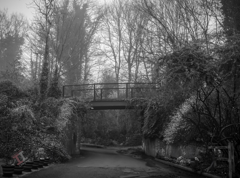
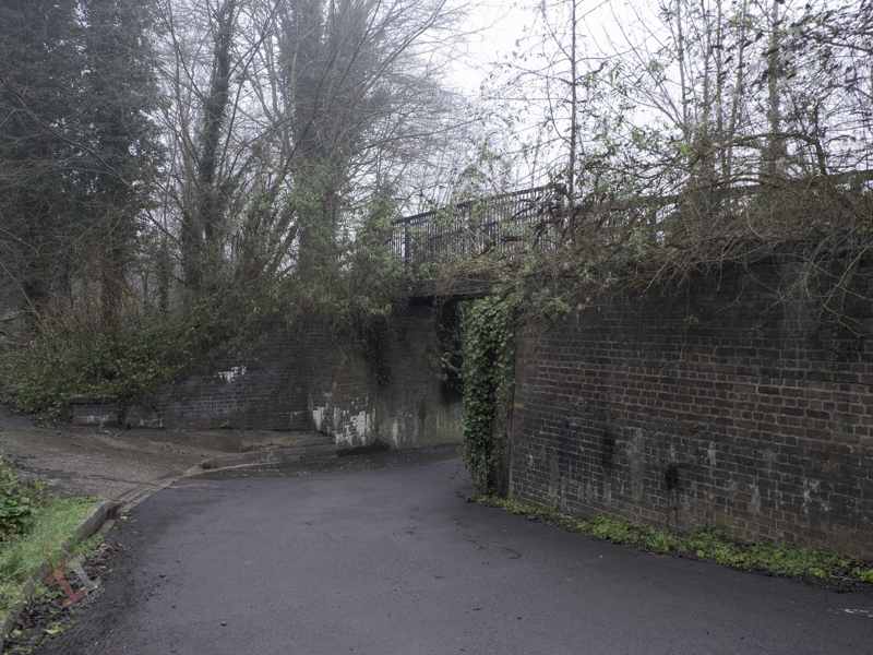
A little further on from the level crossing gates mentioned in Secret Ironbridge: Open Wide, and the Great Western Railway track-laying engineers must have thought that Christmas had come early when they came upon Chapel Lane at right-angles to the railways path.
All they needed to do was build some brick parapets and then drop a ready-made bridge on top, which was in contrast to most of the bridges in the Ironbridge Gorge that needed to be skew-bridges with complex brick-built abutments.
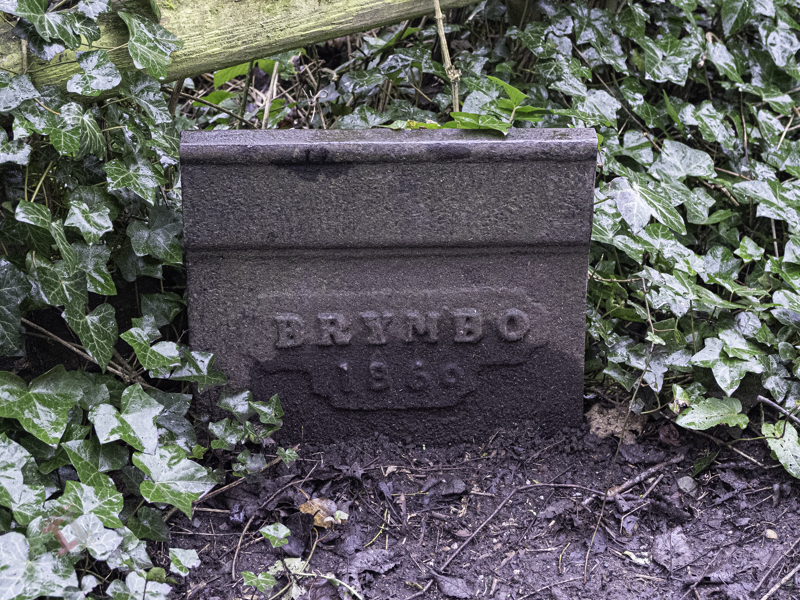
The ready-made bridge they chose was a Brymbo bridge, manufactured in the Denbighshire village of the same name. The Brymbo steel works operated from 1796 to 1991, and there are links with the Ironbridge Gorge because, in 1842, William Henry Darby and Charles Edward Darby (grandsons of Abraham Darby III who built the famous Iron Bridge here in the Ironbridge Gorge) were brought in to manage the works, and so would have been in charge when the little railway bridge was made.
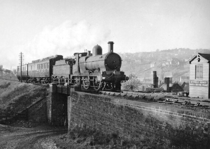
The original Brymbo bridge – photographer unknown
Some years ago major repairs were carried out, and little, if any, of the original Brymbo construction remains. It is now much narrower that the original and has a slight arch to it.
After passing under the bridge, you come across the Coalford Wesleyan chapel, built in 1825, that gave the lane its name (Coalford is an area within the village of Jackfield). John Wesley (1703-1791) was an English cleric and evangelist who led a Methodist religious movement within the Church of England that had its own places of worship in most towns and villages.
In 1884, the Wesleyan Methodists split away from the Church of England to form a new Christian denomination, and later, in 1932, there was a unification with the Primitive Methodists and the United Methodists to create what is now known as The Methodist Church.
The Coalford chapel closed in 1980 and is now used by a local brass band as their practice room.
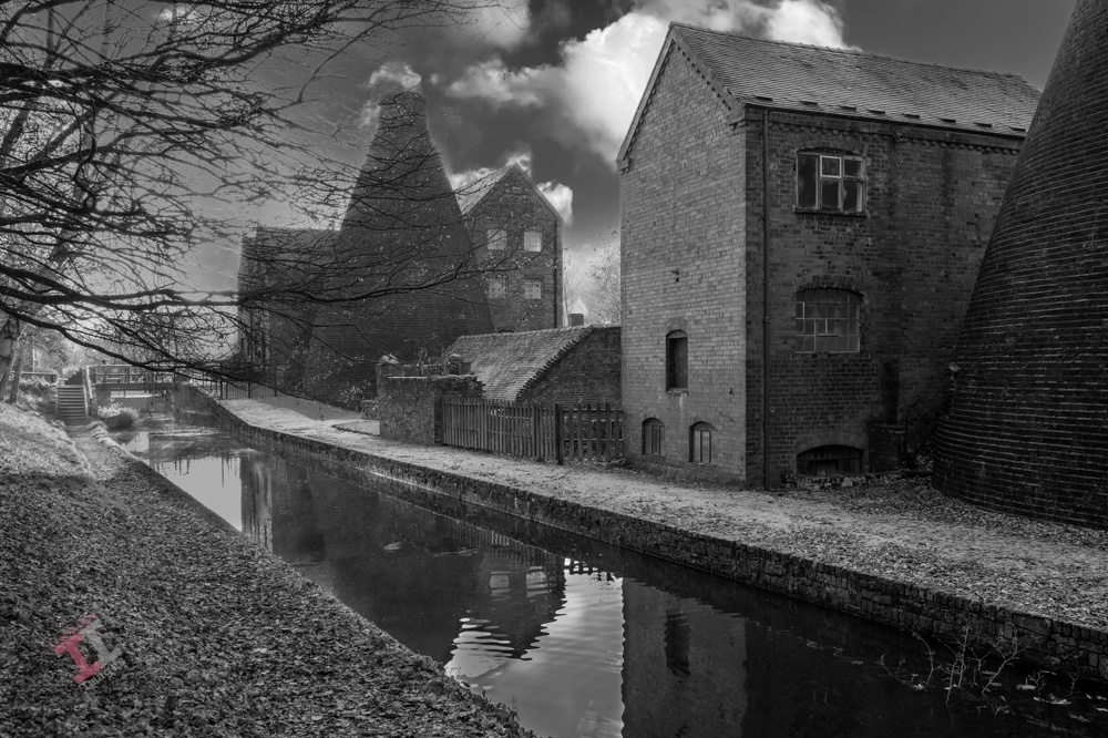
This is a shot of Coalport China Works, just a short walk from my house. It was taken at the end of a particularly damp November, and the towpath was covered in a luminous green moss, which was quite distracting. By removing the colour, that distracting green moss becomes a leading line to take the eye through the image.
Coalport China Works
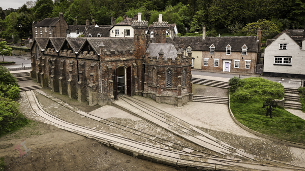
If you have read my blog post; Secret Ironbridge: Transhipment interchange, you will know that Coalport was a ‘new town’ built in the 1790s to service a wharfage between the Shropshire Canal and the River Severn. At about the same time, entrepreneur John Rose had a china factory built on the same site to take advantage of the distribution opportunities that the new canal and river provided.
The remains of the factory (now a museum) are easily recognisable by the two bottle kilns (the name refers to their shape) used to ‘fire’ the pottery. Their distinct profile created an updraught that accelerated the heat from fires at their base. Bottle kilns were very inefficient, but continued to be used throughout the UK until well into the mid-1900s.
Bottle kilns were a common site in the Ironbridge Gorge; the Coalport site originally had six, but there were many more over the river at the Maws and Craven Dunnill tile works.
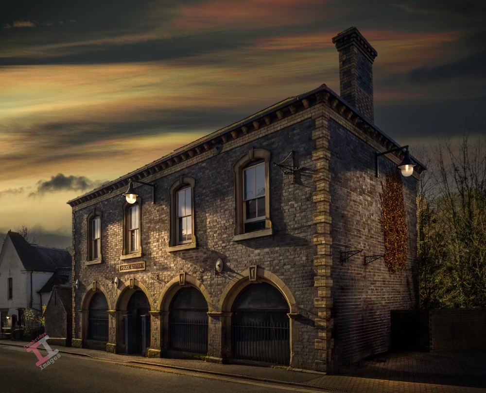
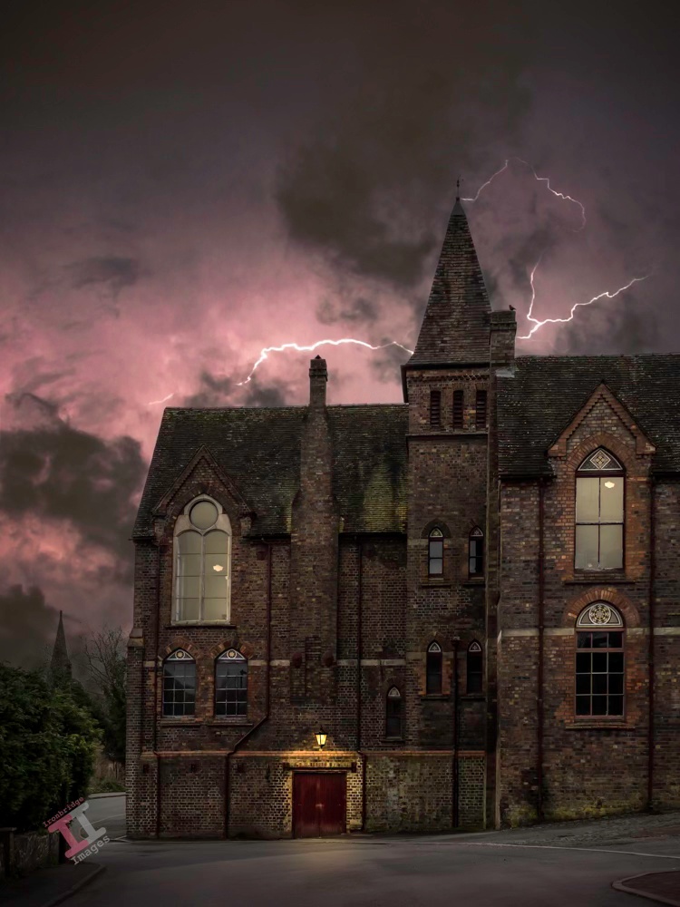
This is the old police station and court house on Waterloo Street in Ironbridge, Shropshire. It was built in 1862 in an Italianate style, with blue bricks and white brick and stone dressings, by a local builder and architect, Samuel Nevett. Similar buildings were built by him in the Ironbridge Gorge with a similar style. Until recently, it was a very fine Indian restaurant called Pondecherry, but unfortunately the economic downturn meant that is was unsustainable and it has closed. The building is currently empty. The image is another from my day-to-night project, processed in Adobe Lightroom and Photoshop.
I firmly believe that the best black-and-white photographs are those that are taken specifically for that genre. However, there is also a common saying:
“If the colour ain’t right, go black & white”
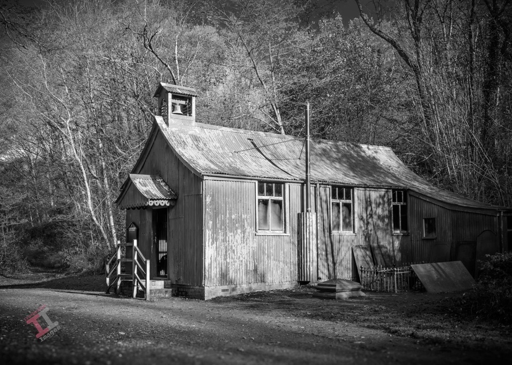
Actually, I’m not sure that it is a common saying, but the image here is a case in point. It has been lying on my hard drive for a couple of years; there was something about it I liked, but the colours just didn’t work. The subject is St Chads Mission Church, a prefabricated corrugated-iron building dating from 1888, originally built at Granville Colliery in Shropshire but now moved into an open-air museum complex. It has been painted, at some time, with a red paint (presumably red-lead, to prevent corrosion) which is a bit garish in a photograph, which I why I never used it.
St Chads Church
However, by removing colour entirely, it produces a much more satisfying image. Of course, this doesn’t just mean desaturating the image of colour, it needs careful post-processing (in much the same way as a colour image) in order to achieve the best tonal values. I use Adobe Lightroom and Photoshop for the task, although many favour a program called Nik Silver Efex.
There is a common error made confusing the terms ‘black-and-white‘ with ‘monochrome‘. A monochrome image is one made up of shades of only one colour (plus white), so this term obviously includes a ‘black and white’ image, as well as a sepia image and a cyanotype. Therefore a ‘black-and-white’ image is a monochrome, but a monochrome isn’t necessarily ‘black-and-white’.
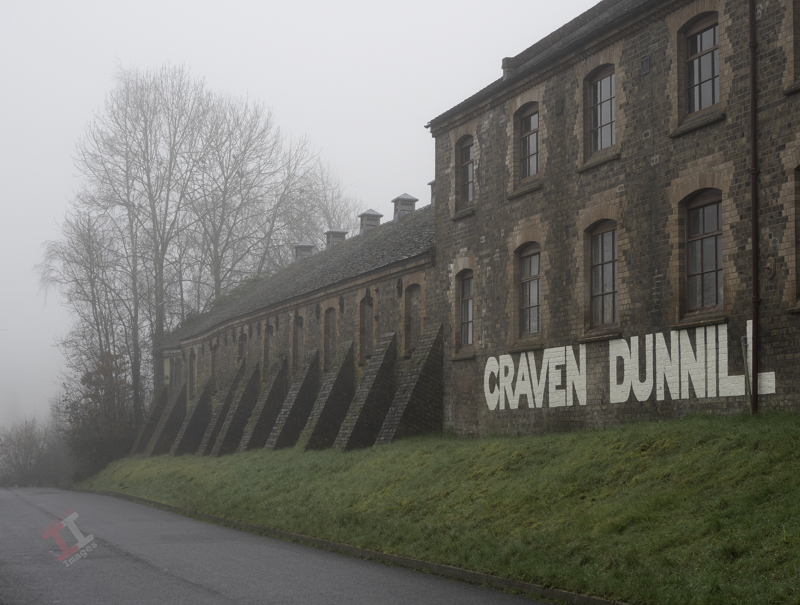
Following on from my recent Secret Ironbridge: Open Wide post, here is the nearby Craven Dunnill Encaustic Tile Works, which was purpose-built at Jackfield, in the Ironbridge Gorge, in 1872. Its formidable appearance lent itself well to this Harry Potter type processing, complemented by the bird that helpfully sat on the roof as I took the shot.
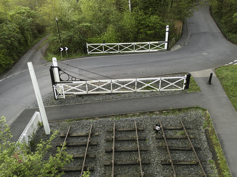
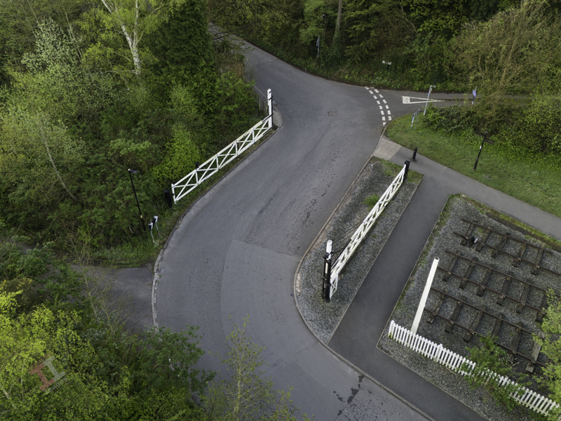
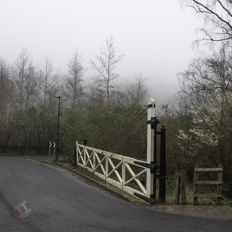
If you drive through the village of Jackfield, you will come to a dog-leg in the road as you cross, what was once, the Great Western Railway line.
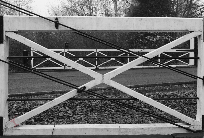
This level-crossing is claimed, at 38 feet (11.5 metres), to be the widest in Britain. Although the railway line opened in 1862, it is likely that the wide gates were added later, as industry in the area expanded.
The current gates remain as a feature but are not the originals. During the last restoration in 2019, it was found that little of the wood was either original, or in very good condition, so it was decided to recreate them using past photographs as a guide (the original blueprints are long-gone).
Unfortunately, after the latest renovation, the signal post was retained but the metal signal arm was not. I must admit that for many years I thought this was an original, but closer inspection showed that it was made out of tin plate. However, I still liked it.
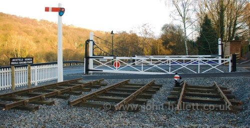
The level crossing in 2009.
The main Great Western Railway line running from Bridgnorth through to Shrewsbury was only single-track. The reason for the wide level crossing was merely due to a complex set of sidings, which primarily served another tile manufacturer in the village: Craven Dunnill, who had the Jackfield Encaustic Tile Works purpose-built in 1872.
The Craven Dunnill factory opened some 12 years before the Maw family moved their tile works from Benthall to Jackfield (see Secret Ironbridge: Maw or less); a site also chosen due to its proximity to the railway, for easy transportation of raw materials in, and finished goods out.
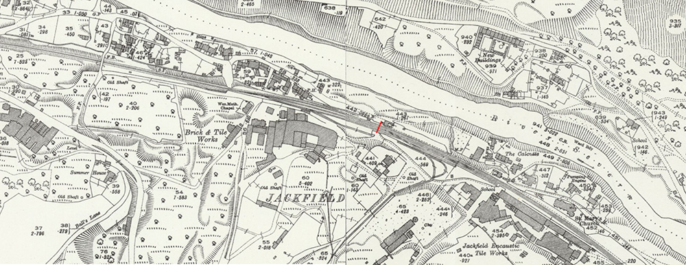
The road now runs where the railway line used to be
The red line shows the position of the level crossing, with the Craven Dunnill factory bottom-right (C.1925)
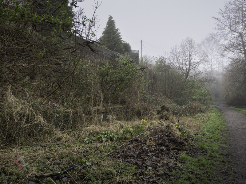
To the west of the level crossing was a small railway platform which served W.P. Jones, another long-gone brick and tile works (as seen in the centre of the above map). The remains of the platform can still be seen in the undergrowth.
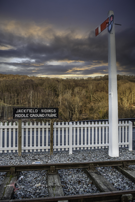
The sidings were controlled by sets of large levers on frames that opened and closed sets of points in the rails using interlinking rods or cables. These frames were mounted outside on the ground and were called, understandably, ‘ground frames’ (as opposed to those mounted inside signal boxes). There were three sets of ground frames at Jackfield, and the middle set were located by these level crossing gates.
Jackfield sidings
The South ground frame was located close to the entrance to the Craven Dunnill factory, adjacent to another level crossing with crossing gates. The North ground frame was located near a small railway bridge that is the subject of the next Secret Ironbridge instalment.