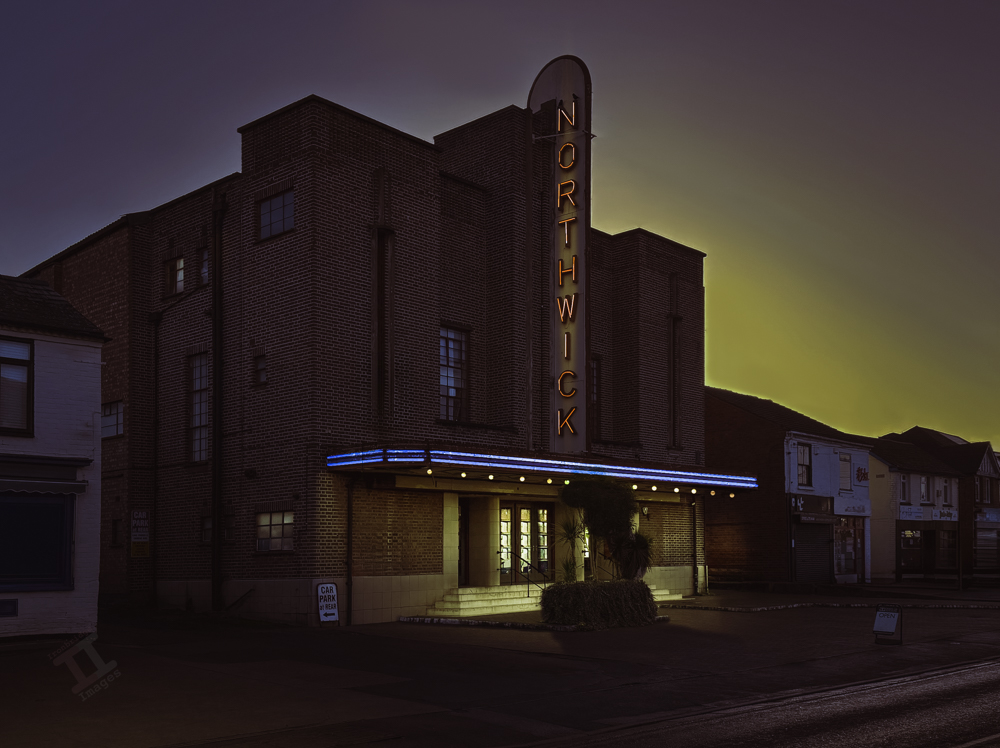
The Northwick cinema in Worcester was opened in 1938. A privately-owned cinema, it had 800 seats in the stalls and a further 300 in the upper circle, and it has classic art-deco styling throughout.
Sadly it closed as a cinema in 1966 and, like many others, became bingo hall until 1982. It had a brief resurgence as a live music venue, and is now an antique furniture shop, although its future is uncertain as they are currently trying to find smaller premises. It is on sale for a cool £1.3 million.
This is another of my day-to-night projects. Unfortunately, online image reproduction routinely ruins the overall contrast in these type of images and so they never look as good as they do on my monitor.
Yesterday we spent the morning in the city of Worcester and I made a considered effort to take some photographs with my phone camera, on the basis that my mission for the New Year is to (a) use it more often, and (b) learn how to use its various functions.
There is clearly much to be done. Apart from the fact that I was clumsily touching the screen and randomly turning the camera off whilst I was trying to use it, I was also struggling to come to grips with the new ‘camera control’ button, that I didn’t have on my previous iPhone, which, apart from activating the shutter, also has various functions that I didn’t know about and (again) my stubby fingers were changing settings without me realising.
Back at home, I also found that the default HEIC image format isn’t fully compatible with Photoshop and so that has now been changed so that I can easily choose between JPEG and RAW. I have also downloaded a book onto Kindle called “iPhone 17 User Guide” which I will now actually read so that I don’t get so frustrated the next time.
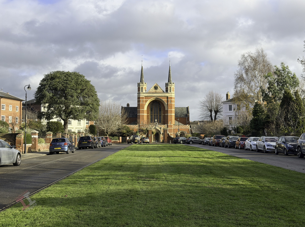
Anyway, here is a shot of St Georges Square, Worcester, with St Georges Church in the background – which was built in an Arts and Crafts style in 1895. I may convert this into a day-to-night image later on.
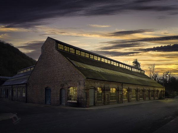
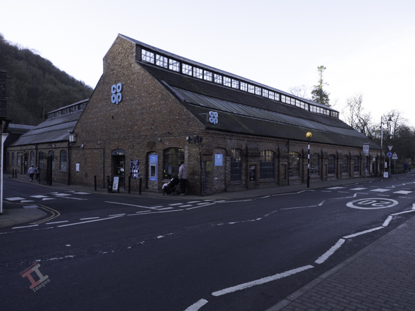
I make no excuses when I state that this is a heavily-edited image of the Merrythought teddy-bear factory in Dale End, Ironbridge – now more commonly known as the Co-Op.
Taking a memorable photograph of this building now is virtually impossible due to the multitude of signs and road markings that adorn the exterior. I started my post-processing by removing some of the signage and people, but as I progressed, it seemed that the final image was going to work far better if it became more of a re-creation of the building in its heyday.
This took some more careful editing, including replacing some of the doors that were originally there. Finally, I replaced the boring, plain Winter sky with a golden sunset and made a day-to-night conversion, which included lighting the interior of the building.
Some may say that this is taking editing too far – but I think that it makes a nice image of an industrial building that is otherwise uninspiring. What do you think?
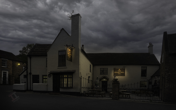
Situated right opposite my best friends house, I spent many teenage evenings in this hostelry. Banks’ mild was 70p a pint and a beef burger in a bun was 50p – so you could have a decent night out for less than a fiver! As you can guess, this was a fair few years ago.
I haven’t set foot inside for decades now, but the outside looks much the same as I remember it. I had been past a few times to get the shot but there had always been a delivery van or car parked in front, however on this occasion I was pleasantly surprised to find it it was clear and quiet.
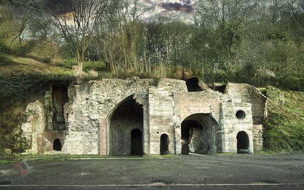
The Bedlam Furnaces are situated a short distance from Ironbridge Town, downstream of the Iron Bridge. The furnace ruins have been disfigured by a large metal canopy installed by Historic England to protect it, and so I have ‘recreated’ how it used to look in the image below.
It is believed that these furnaces were given the name by a couple of artists in the early 1800’s who thought that the site resembled a lunatic asylum (presumably because it appeared so chaotic and dangerous). The furnaces were built in 1756 and some believe that parts of the Iron Bridge were cast here, due to their close proximity to the river crossing site compared to the furnaces at Coalbrookdale.
The term “bedlam” originates from the name of a hospital in London, “Saint Mary of Bethlehem,” which was devoted to treating the mentally ill in the 1400s. Over time, the pronunciation of “Bethlehem” morphed into “bedlam” and the term came to be applied to any situation where pandemonium prevails.
Behind the furnaces is an area which some (older) locals will recall used to be the site of a large natural gas tank that supplied the town with its gas, for lighting, cooking and heating, before the days of ‘mains’ gas. It was later landscaped into ‘Galleon park’, so called because it had a giant wooden ship as a play area. Sadly, this has now rotted away and the park is barely maintained.
Bedlam Furnaces, Ironbridge Gorge
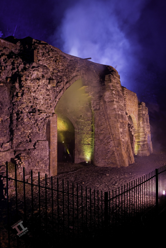
Back in September 2008, there was a ‘festival of light’ at Ironbridge, where various landmarks were illuminated with a light show – including Bedlam Furnaces.
Here is one of my shots from the evening – it created an ethereal glow over the ruins.
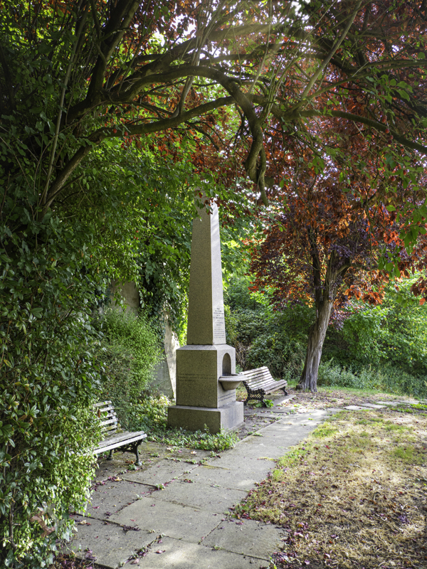
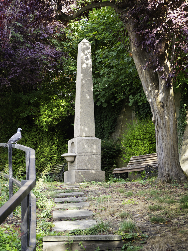
In the early 1800’s there was no mains water supply in Ironbridge and so many just used the water from the river Severn for drinking and cooking.
Bartlett Fountain, Ironbridge
Profit from sales of this image will go to the ‘Return Bartlett Fountain to Ironbridge square’ GoFundMe page
Unfortunately, there was no sewage system either – and that just flowed straight into the same river. Unsurprisingly, this led to deaths from cholera and other diseases, so widespread that a mass grave was created for the victims (see Secret Ironbridge: A tale of two churches).
In 1823, the Reverend John Bartlett became the vicar in nearby Buildwas, and the estate in which he lived had its own drinking well. Concerned about the deaths in Ironbridge he persuaded industrialist Abraham Darby IV to install pipes to bring fresh water into the town from this well.
After his death in 1861, his widow had a 15 foot high red granite drinking fountain erected the Ironbridge Square in his memory.
Unfortunately, in the 1960’s, the Telford Development Corporation decided that a bus stop was more important and relegated the fountain to the back of a small car park, where it remains today.
The Ironbridge and Coalbrookdale Civic Society are actively trying to get the fountain rightfully replaced in the Square, and are attempting to raise funds to go towards the estimate £40,000 required by Telford & Wrekin Council to do so. You can donate towards this cause on their Go Fund Me page.
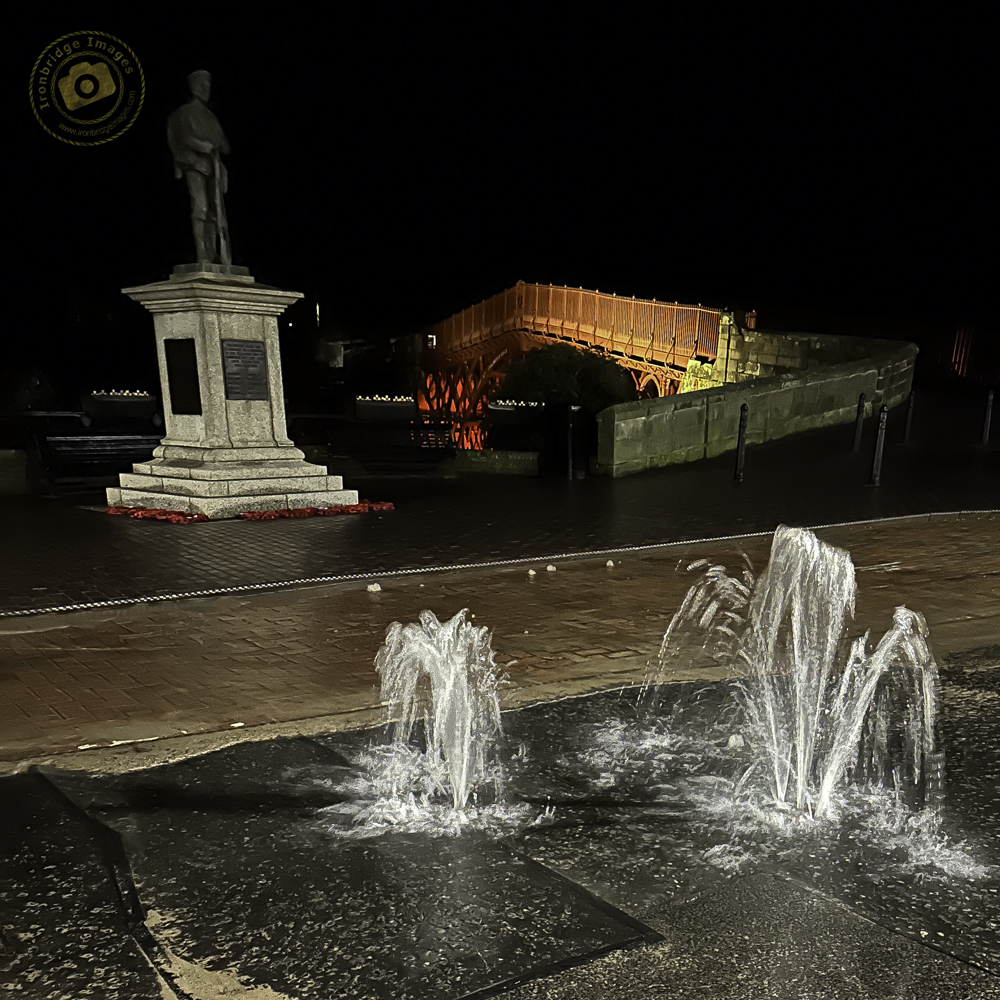
Not the Bartlett fountain – just a water leak in the road in February 2024
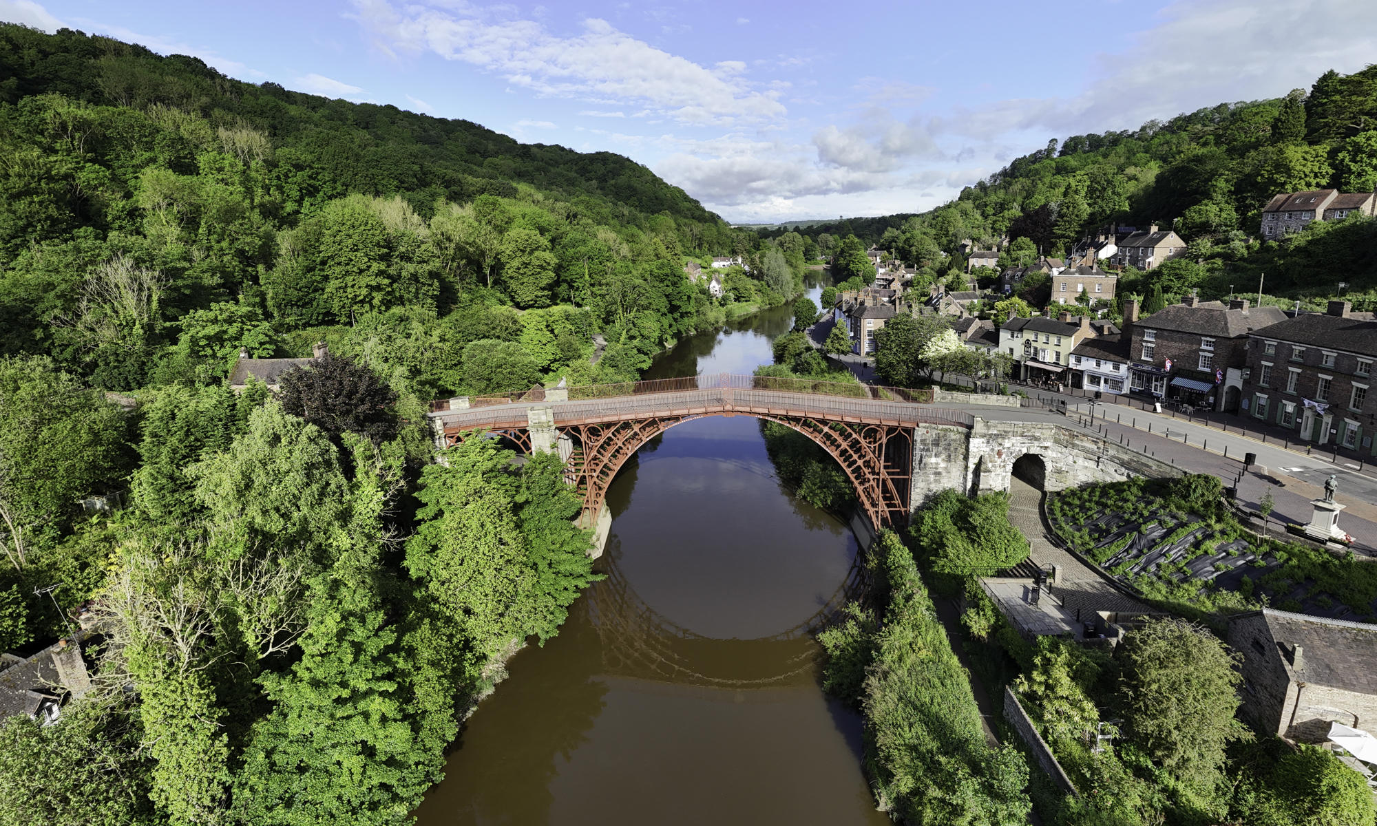
I have recently read a book called “Dynasty of the Iron Founders: The Darbys and Coalbrookdale“, written by Arthur Raistrick and published in 1953. It’s a heavy-going tome and a difficult read, charting the early days of iron founding from the early 18th century through to more modern times (well, the 1950s anyway). The whole story is spread over many more years than I had been led to believe from my school days and involved a lot more people. The famous bridge (pictured above) was just a small part of the tale and was built (primarily) by Abraham Darby III (the story is complicated by the fact that each generation of the Darby family called a son ‘Abraham’, and the book makes it more complicated still by often forgetting to define which one it is referring to.
You can buy a used copy of the book from Amazon for just £5. It’s worth battling your way through it if you are interested in the history of the Ironbridge Gorge and those who shaped it.
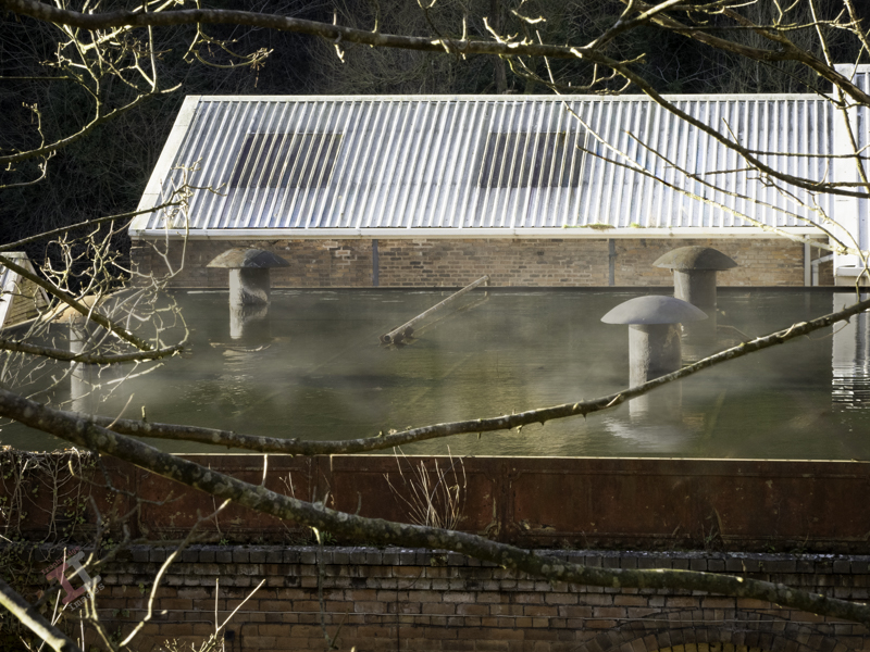
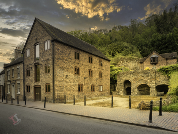
If you walk down Wellington Road in Coalbrookdale, just past the Coalbrookdale Inn and the junction with Church Hill, you can see an industrial building with a flat roof and (what appears to be) four metal mushrooms growing out of the top.
This building was the compressor house for the Coalbrookdale Works. The compressors were water-cooled (compressing air generates a huge amount of heat) and the heated water was pumped through the mushroom domes onto the flat roof to allow it to naturally cool, before draining back down to the compressors below to repeat the cycle. I can vividly remember as a child, when visiting my Aunty who lived nearby, passing by this building and seeing the hot water gushing from the domes, with plumes of steam rising from the rooftop as it cooled.
The compressor house is included with the Erecting Shop and Assembly Shop as a listed building. These buildings date from 1879, although it is likely that the compressor house was a later addition. Recently, there was a planning application to modify the building for residential use (as part of a much larger plan to redevelop the Coalbrookdale Works site) which would have meant the loss of the rooftop water tank, and hence any indication of its past function. Fortunately, on appeal, the Secretary of State’s inspectorate made it quite clear that this was not acceptable and so, for the time being, the compressor house remains.
It may be coincidental, but Heras security fencing and unmanaged undergrowth now mask the view of the compressor house from the road. I managed to get this shot through the fencing and, with a bit of post-processing, cleared the view. I have also added a bit of steam in a nod towards my childhood memory.
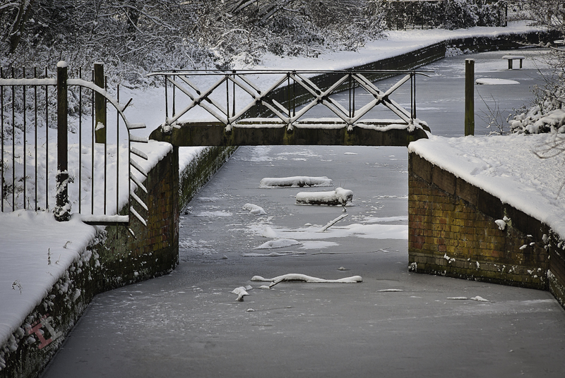
This narrow cast-iron footbridge crosses the Shropshire Canal close to the Coalport China Works.
Although it looks original, it is actually an impostor, and was brought in from the Shrewsbury Canal at Long Lane near Wellington when this section of the Shropshire Canal was restored in the 1970’s. When you think about it, this canal was built for an industrial purpose – to transfer tub boats of coal on the Transhipment Interchange from the canal, to the river – and the last thing that the barge haulers would need would be another bridge crossing over the canal, limiting the height of the load on the tub boat and snagging the rope used to pull it. There was a bridge, but this was at the entrance to the Coalport China Works.
A little bridge
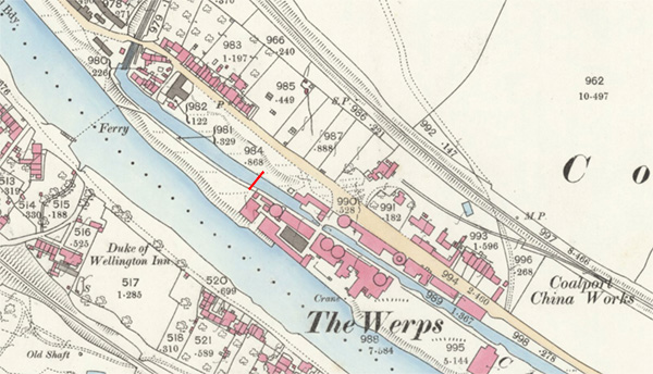
Here is an Ordnance Survey map from 1881 and I have placed a red line in the approximate position of this impostor bridge. As a point of interest, prior to the 1890s the buildings on Ordnance Survey maps were coloured; carmine (pink) for buildings of brick or stone, and grey for buildings of wood or metal. The colour was applied by hand, either by boys or women, paid on a piece-work basis.
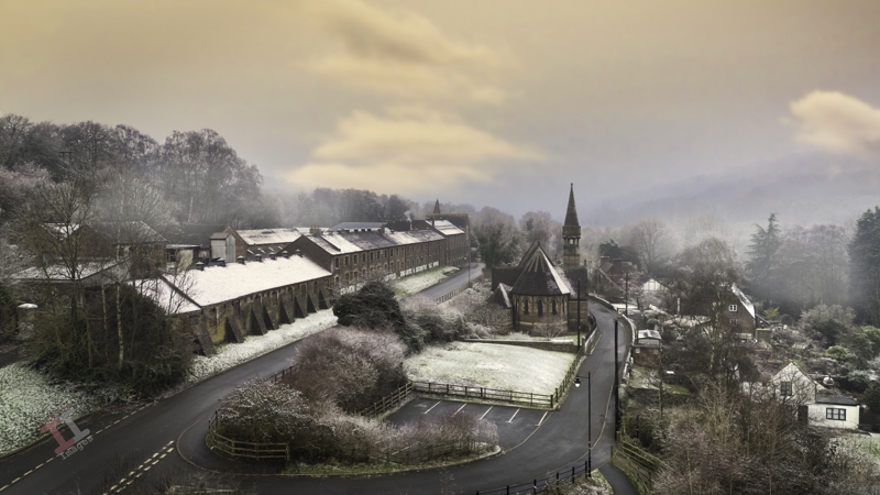
A frosty morning in Jackfield, following a particularly cold spell in January. The sun tried to make an appearance and raised the temperatures sufficiently for me to take my drone for a short flight and I captured his image of the spire of St Marys church, contrasting the stark, Victorian architecture of the Craven Dunnill tile factory.
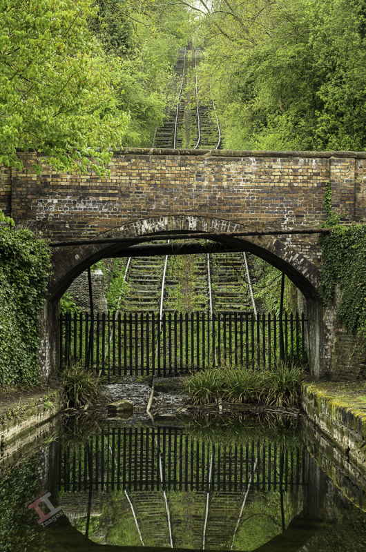
This narrow road bridge crosses the Hay Inline Plane at Coalport. Most people probably don’t even give it a thought, apart from when they have to give way to oncoming traffic, but the bridge dates from around 1792, the same time that the Hay Incline Plane was built, due to the bridge crossing it, at the point that it meets the Shropshire Canal at its low level, adjacent to the river Severn.
The bridge is a Grade II Listed Building and the small building to the left must, judging by its orientation and layout, have originally been a toll house. For many years it was the village shop but more recently has been a barbers, and now a hair-dressing salon.
Bridge over the Hay Incline Plane
In 1801, the chain pulling an empty tub boat and cradle up the incline snapped, sending both hurtling into the canal just below the bridge, destroying another three tub boats in the canal. Shortly afterwards, wire ropes replaced the chains because these were less likely to become worn and snap.
The last recorded use of the incline plane was in 1894 and it formally closed in 1907. The original tracks were removed and the incline became overgrown – the tracks laid on the incline today are merely a re-creation of what they were – in reality, the centre of each track would have rollers to support the wire ropes pulling the tub boat and cradle up the incline.
The day after Christmas, 2024, and the Ironbridge Gorge was covered in a layer of mist that lasted from morning to night.
Here is Holy Trinity church at Coalbrookdale, built in 1854 at the behest of Abraham Darby IV, one of the Coalbrookdale ironmasters, who’s grave lies in the churchyard.
St Luke’s church tower can be seen behind a silver birch in this view from St Luke’s road in Ironbridge. There are many gems to be found in the back streets of the town if you care to look for them.
Set back from the road, on the Wharfage at Ironbridge, are these three arches which, from studying a map from 1882, are most likely to be lime kilns.
Limestone was commonly used in iron smelting as a flux to remove impurities. However, only the highest quality limestone was used for this purpose and the lower quality was burned in kilns, such as these, to produce quicklime which was used in building mortar and lime wash. The kilns operated at 900 degrees Centigrade and would have filled the air with noxious fumes that would have hung over the river, making it an unpleasant place to be.
This flowering cherry tree is in juxtaposition with the stark and formal Victorian architecture of the Coalport china works, with its remaining bottle kilns standing tall.