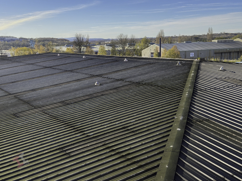
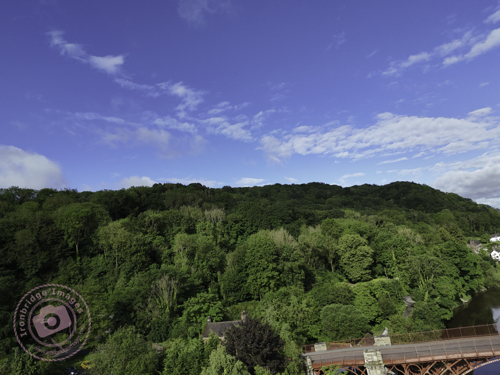
Yesterday I was viewing the factory roof at TCL Packaging from a rather large scissor-lift, some 15 metres in the air, whilst contractors explained some work they are going to be doing next week. I took some record shots with my iPhone 17 Pro Max and, when viewing them later, couldn’t help noticing the superb image quality, particularly of the distant Shropshire countryside.
It makes me think that I really should use my phone camera more often (since it is nearly always with me) now that the results are arguably as good as from a dedicated camera.
Of course, you have to deal with camera snobbery; “a phone camera isn’t as good as a dedicated camera”, “a micro four-thirds isn’t as good as an APS-C”, “an APS-C isn’t as good as a full-frame”, “a full-frame isn’t as good as a medium format”, etc, etc. I have been lucky enough to have had most of these types of camera (albeit I leap-frogged from APS-C to medium format and never owned a full-frame) and can honestly say that it never made any appreciable difference to the quality of my images (or course, I haven’t printed out any billboard-sized ones recently!).
So, my intention is to take more photographs with ‘the camera in my pocket’ – although I seem to remember saying the same thing the last time I upgraded my phone!
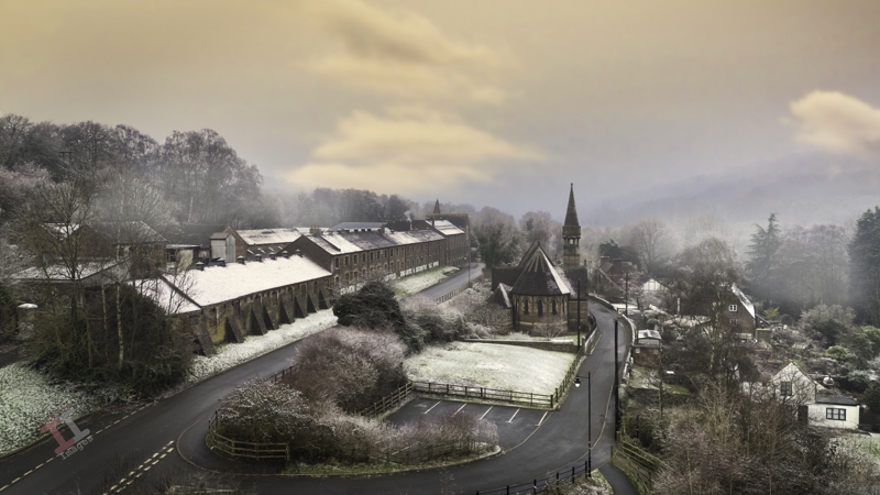
A frosty morning in Jackfield, following a particularly cold spell in January. The sun tried to make an appearance and raised the temperatures sufficiently for me to take my drone for a short flight and I captured his image of the spire of St Marys church, contrasting the stark, Victorian architecture of the Craven Dunnill tile factory.
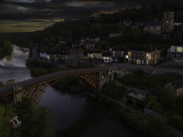
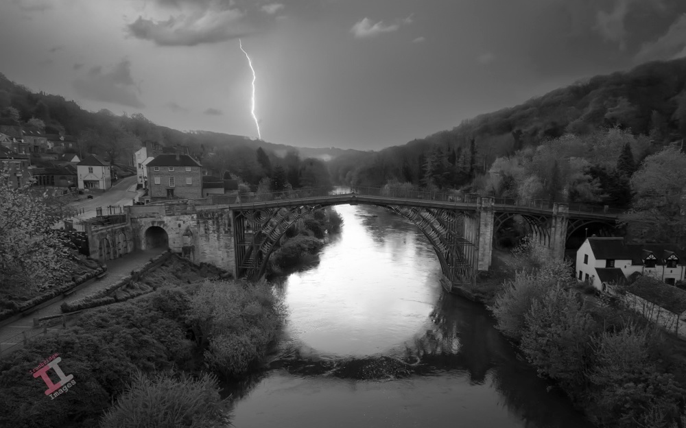
This is my largest day-to-night conversion to-date and took a fair amount of time and many, many masks to create. It was all great fun though and I’m quite pleased with the result.
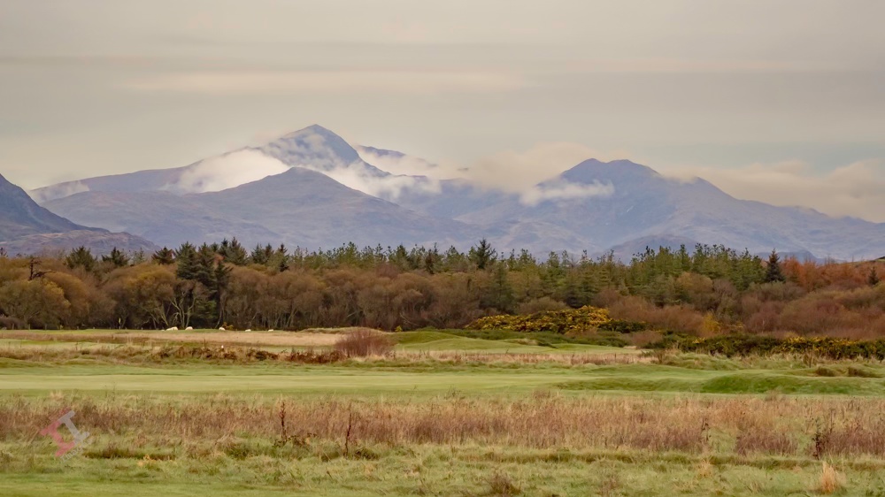
We recently took a trip 100 mile west, to the Welsh coast at Harlech. It was surprisingly mild for November and we spent a good 3 hours on the beach with the dogs (Harlech has a lovely long, flat, sandy beach). In fact, the weather was so good that I managed to fly my drone and flew it over, and beyond, the sand dunes to capture this shot of the Snowdonia mountain range, with the clouds nestling in the valleys.
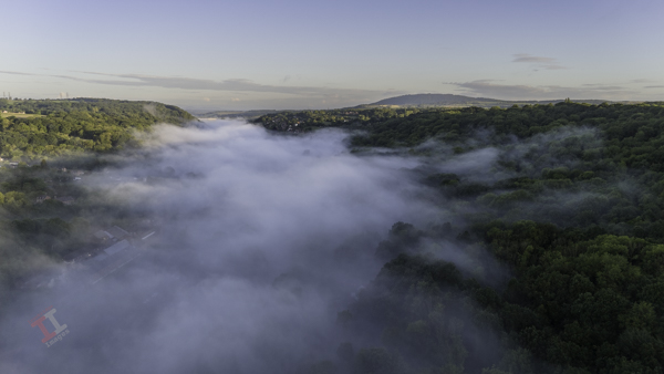
Visibility was limited when I opened the blinds in the kitchen window this morning – a thick blanket of mist had descended into the valley. I took the opportunity to fly the drone above the cloud to capture this image over the Severn Valley.
Ironbridge Gorge Cloud Inversion
Within 30 minutes the mist had cleared and we were ready for another day of summer sun rain.
This type of phenomena is called a ‘cloud inversion’ and is caused when temperatures near the ground are lower than those higher up in the air. It is more common during Autumn and Winter, typically just after sunrise.
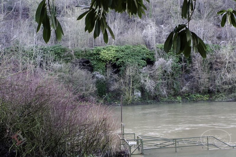
As the Great Western Railway passes Bowers Yard and heads towards the site of the old power station, it runs very close to the River Severn, and so the Victorian engineers decided that the best solution was to build a viaduct parallel with the river.
A viaduct is a specific type of bridge that consists of a series of arches, piers or columns supporting a long elevated railway or road, typically connecting two points of roughly equal elevation. Contrary to popular belief, if doesn’t necessarily have to be crossing over water. Such is the case here; the viaduct merely elevates the railway above the banks of the river, it doesn’t actually cross it at any point.
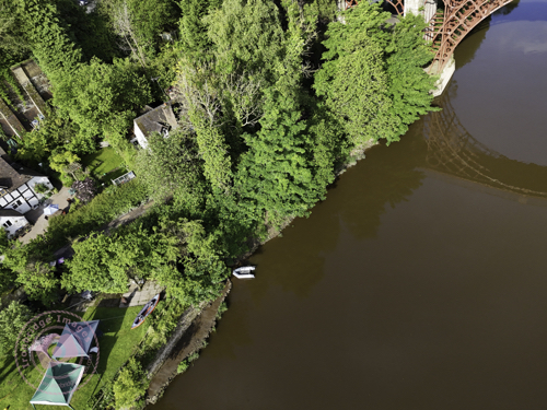
It is easy to miss another great feat of Victorian engineering; although you can still traverse the viaduct by foot, the base of it has become surrounded by trees, and ivy clings to the brickwork. Fortunately, my drone was able to fly over the river and catch some shots that otherwise would remain unseen.
There has been some recognition of the viaduct and a lot of ivy has been removed since my shot taken in 2013:
This image encompasses two of my current projects: it is a day-to-night conversion (including a sky replacement) and a black-and-white conversion. It was taken with my drone, early one morning before the town had started to come to life and post-processed with Adobe Lightroom and Photoshop.
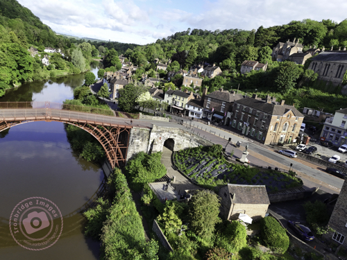
Yesterday I managed to complete another task off my to-do list; and took a photograph in order to create new headers for my website and Facebook page. The dimensions for both are quite specific (and different to each other) and it required a wide-angle shot so that it could be cropped quite heavily to suit the size and aspect.
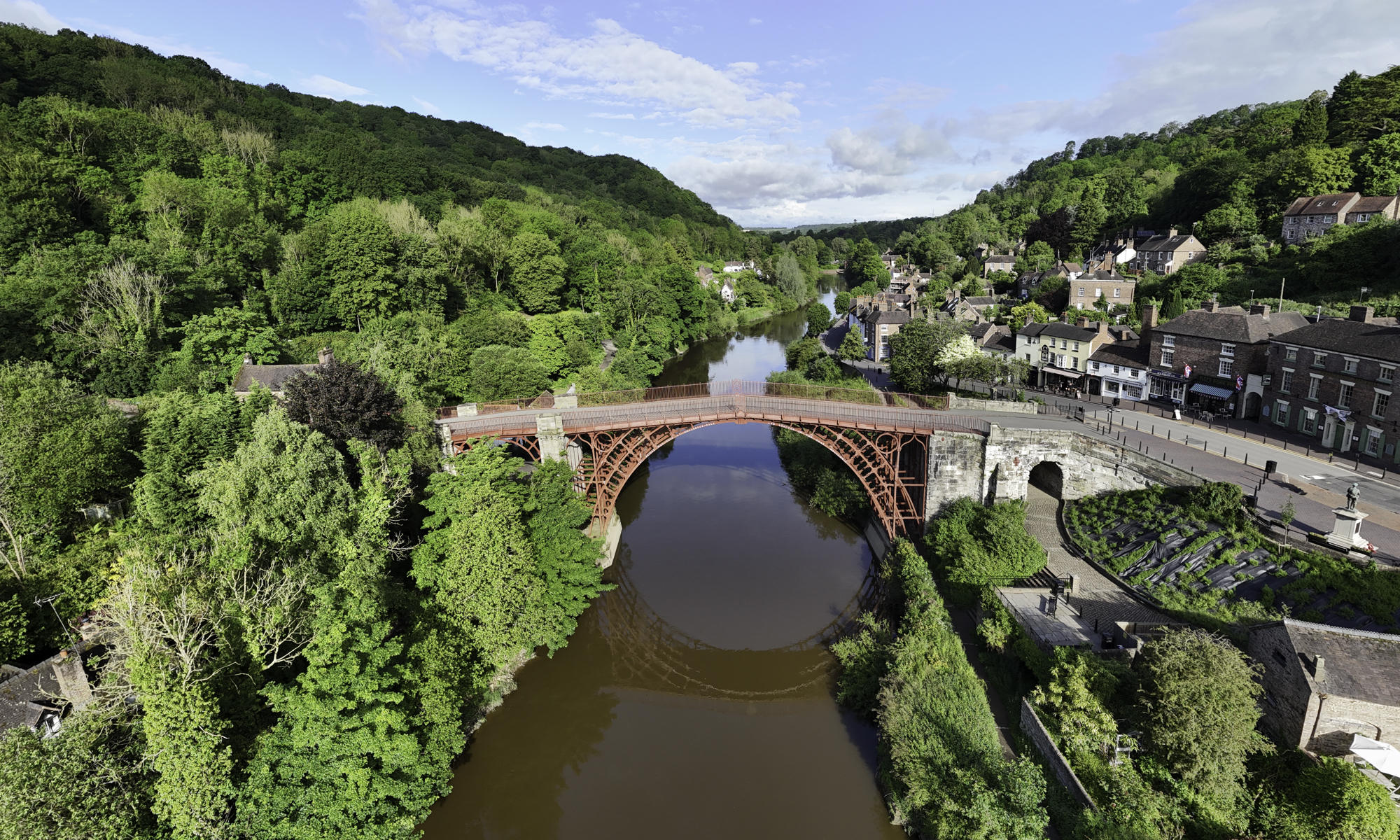
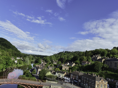
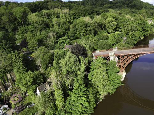
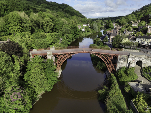
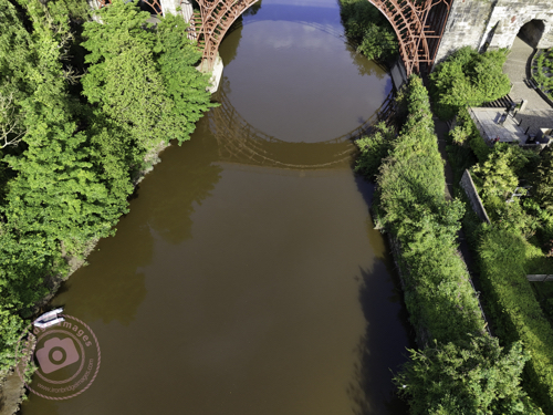
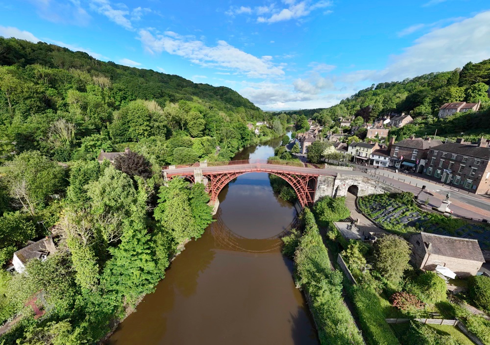
I wanted an aerial shot of the Iron Bridge, and so this either meant taking it from a long way off (and then losing detail) or using the panorama function of my DJI Mini 4 Pro drone – the latter turning out to be the ideal choice.
Even though it was 8.30am on a Bank Holiday, it was surprisingly quiet and deserted, and therefore ideal to fly the drone from a seating area directly in front of the bridge. There are four panorama options on the drone; Sphere, 180o, wide-angle, and vertical, but my preferred one, that produces a more natural image without too much stretching of perspective, is the wide-angle – which takes 9 shots in succession and seamlessly stitches them together (within the drones software) to create one large image. You can then output not only the large panorama image, but also the 9 individual shots.
And here is the complete panorama, which I later cropped to produce the headers for my website and Facebook page:
Iron Bridge Panorama
Please don’t forget to visit my new Facebook page and give it a ‘like’. Thanks
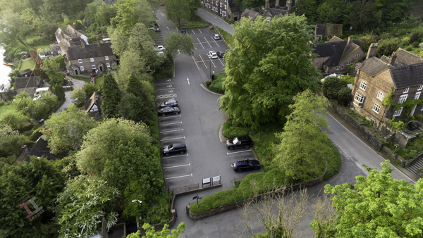
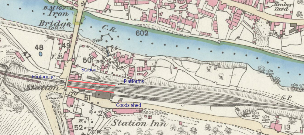
If you visit Ironbridge by car, you may well follow the signs to Ironbridge Central car park and wonder why it has that name, given that it really isn’t ‘central’ to anything.
This was a name dreamt up by the illustrious Telford & Wrekin Council, but the car park is still known by locals as ‘Station Yard car park’. Why? Because it is on the site of a long-gone railway station on the Great Western Railway (GWR) line.
This entire car park was once a bustling railway station
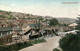
It was named Broseley and Iron Bridge station on the basis that, at the time it was built in 1862, the majority of the stations passengers came from nearby Broseley, which had a much larger population than around the bridge. During its life the name changed several times (perhaps by grammatical pedants) and was called:
Ironbridge and Broseley
Iron Bridge and Broseley
Iron-Bridge and Broseley
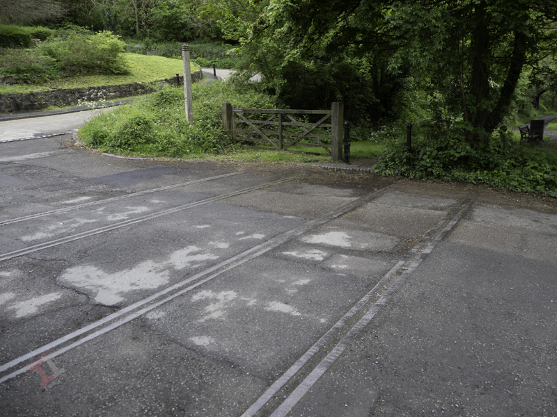
Apart from the single-storey station building adjacent to the bridge, there were two platforms, a a lattice footbridge connecting them, a substantial signal box, numerous sidings and a goods shed. There was also a level crossing (the remains of the track can still be seen) controlling traffic crossing the bridge.
The only remains – railway tracks crossing the bridge approach
A popular postcard of the time shows the signal box, footbridge and level crossing gates.
A map of 1883 shows that, just 20 years after it opened, the station yard was a busy place and subsequent maps show that the layout remained largely unchanged throughout its 101 years life.
The rise in popularity of the motor car (and road transport in general) meant that the railways went into decline after the Second World War and eventually the line closed in 1963. Many blame the infamous Beeching Report for the lines closure but, in reality, its future had already been decided due to lack of use.
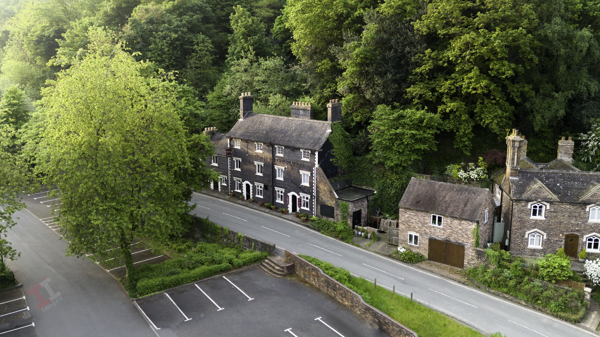
Overlooking the Station Yard is the aptly-name Station Hotel (now a restaurant called D’arcy’s at the Station), an imposing Grade II-listed, blue-brick, three-storey building originating at the same time as the railway.
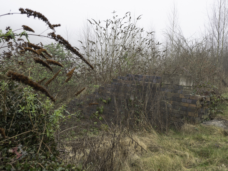
As I mentioned in a previous post; Secret Ironbridge – Great Western Railway, in 2003 I embarked on a project to photograph all 25 of the bridges in the Ironbridge Gorge. Only one of them is no longer standing, but the remains of its abutments can still just be seen, not far from the Maws tile works in Jackfield (see Secret Ironbridge – Maw or less).
The bridge itself was the victim of land slippage, which eventually led to significant stabilisation groundworks in 2015. At the time, the remains of the bridge were earmarked for removal, but they were saved at the last minute.
The bridge abutments can just be seen rising out of the undergrowth
Originally, the bridge only carried the single-track GWR through-line, but in about 1910, a siding was extended over the bridge, although it is not clear if it was widened to accommodate this.
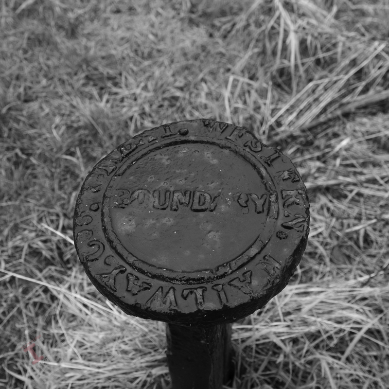
A GWR boundary post is situated nearby – although this is not its original position.
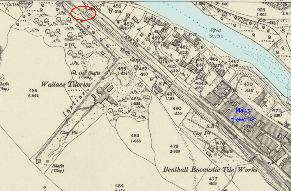
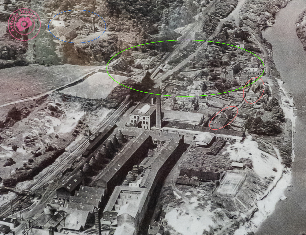
The bridge was built to cross a lane that provided access to Wallace Colliery, a very small coal mine that opened in the 1800s and is believed to include pits called ‘Bonny’ and ‘Jolly’. In the 1880s, attention turned to extracting clay, and Wallace Tileries was born on the same site, which quickly expanded, with a large building and even its own incline plane, tramway and railway siding linked to the GWR line. It was reputed to be the first roof tile works in the world with a tunnel kiln. It was short-lived; it had declined by 1920 and closed in the late 1930s, possibly due to the clay pits being exhausted.
Wallace Tileries in 1901. The bridge is circled in red.
There were some who believed that the closure, and subsequent cessation of pumping water from the pits, may have contributed to a significant landslide in 1952, when 27 dwellings were destroyed, as the ground on which they were built moved some 60 feet (18 metres) towards the river (the mines are directly above the area that was affected). There was, allegedly, an underground lake that could be seen down one of the pits. Perhaps unsurprisingly, official reports claim that this lack of pumping was unlikely to have caused the disaster.
Was the location of the tileries in relation to the landslide a coincidence? What do you think?
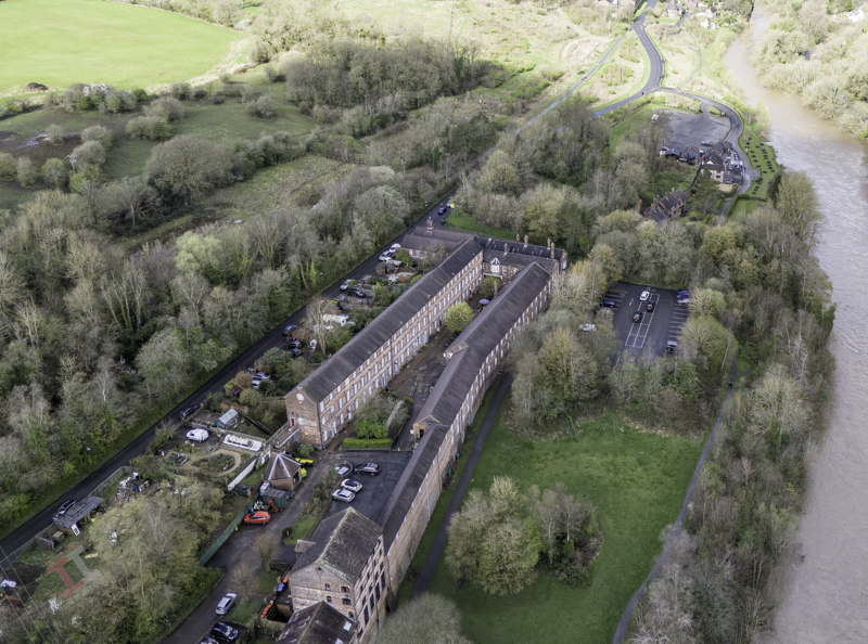
A 1942 aerial photograph, before the landslide. The Wallace Tileries are circled in blue, the houses affected in green. The houses circled in red still remain and can be seen in the image below.
A similar viewpoint today. See if you can spot the remaining buildings.
There is an interesting British Pathé news clip about the landslide on YouTube here, which also blames the cessation of pumping for the disaster.
The remains of the abutments are barely holding together
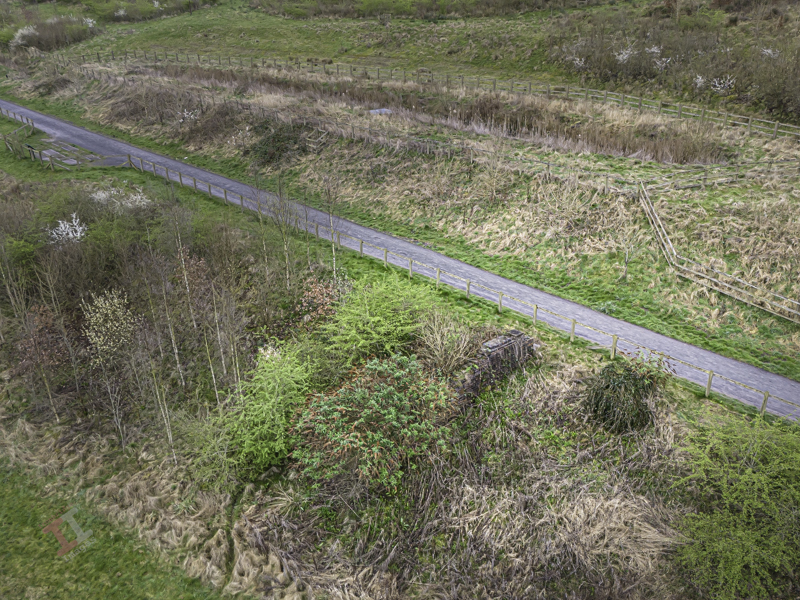
The abutments can just be seen. The footpath almost follows the line of the railway
Despite some considerable searching, I cannot find a photograph of the original bridge. It is very possible, given that the railway crossed the narrow lane at right angles, that it was a ready-made metal bridge laid on top of the brick abutments, similar to one that will be discussed in a later Secret Ironbridge blog post.
But that’s later; the next Secret Ironbridge blog post will be a little more ecclesiastical.
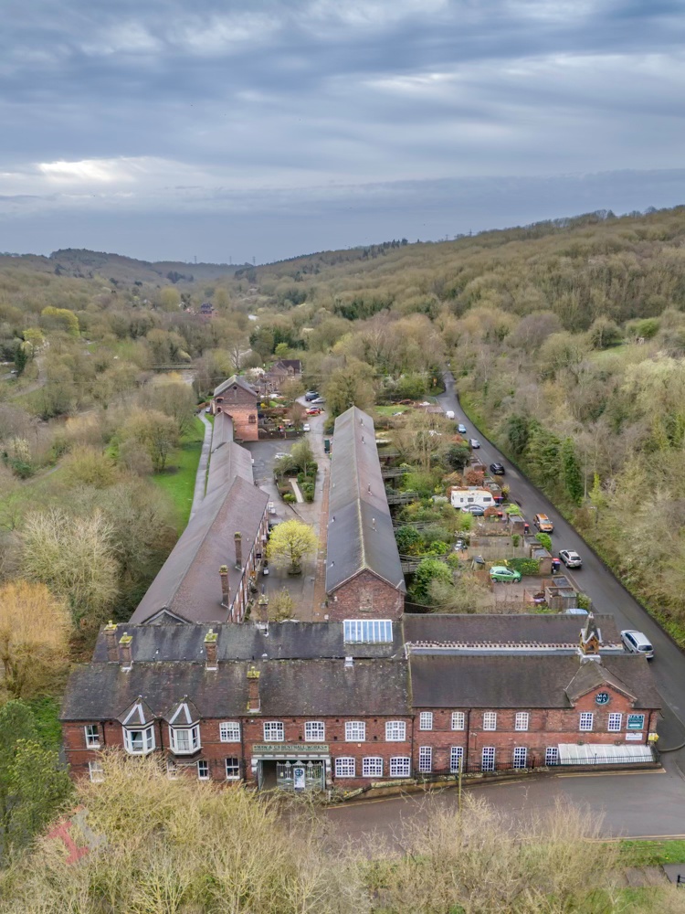
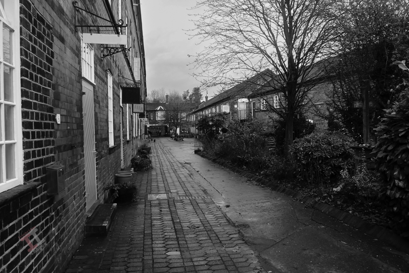
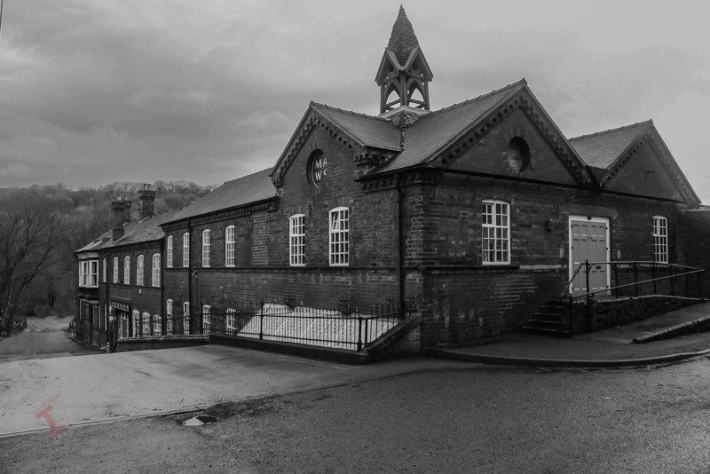
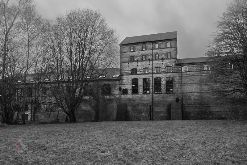
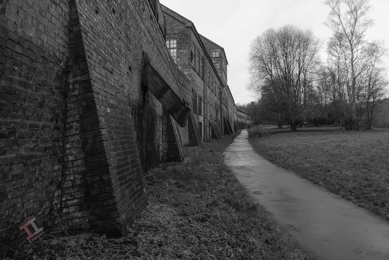
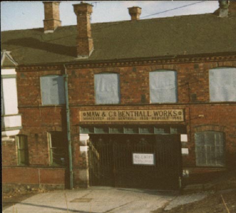
In Victorian times, the Ironbridge Gorge was home to numerous brick and tile works, due to the abundance of coal and, of course, clay. Most of these were small concerns, but occasionally a business would expand exponentially and become a major part of the community. An example of this is Maws and Co. in Jackfield.
Maw or less
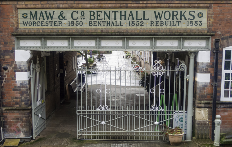
The company was founded in Worcester in 1850 by John Hornby Maw and his two sons, George and Arthur, but the shortage of good quality clay in that area meant that they shifted the entire operation (including the employees) to Benthall, near Broseley, in 1852. To take advantage of the transportation opportunities of the new Great Western Railway line, the site relocated again in 1883 to the site of an existing brickworks at Jackfield (this explains the somewhat confusing name “Benthall Works” above the entrance).
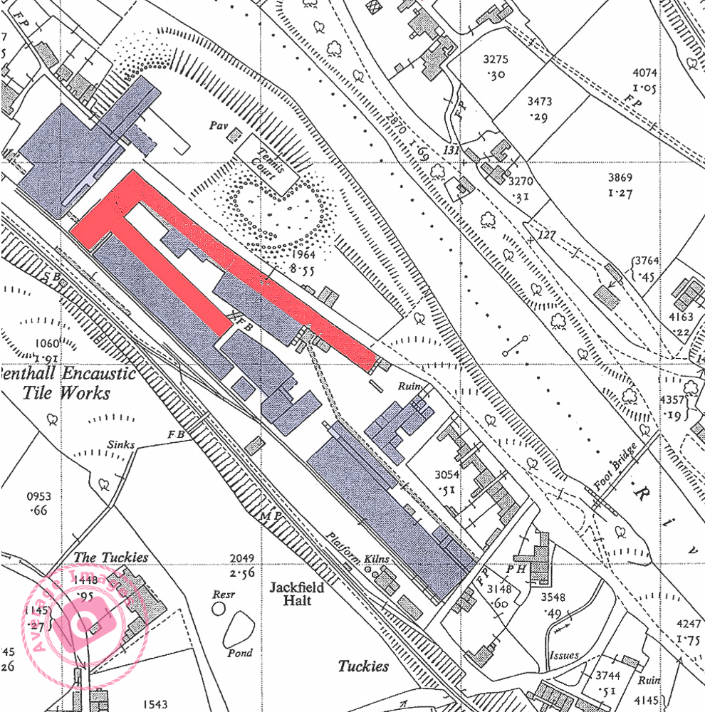
Today, you will find the works if you follow the signs to the Maws Craft Centre – its courtyard now taken up by artisan craft shops. As you walk down the courtyard you may be impressed by the size of the buildings – but in reality this is just one third of the size of the original works – the majority demolished in the 1970s. The map below shows the remaining buildings in red – with the rest of the (now demolished) works in blue. You will also notice that it had its own railway platform and sidings from the GWR line (see Secret Ironbridge: Great Western Railway) – the current road didn’t exist at that time. In its heyday, it was the largest encaustic tileworks in the world and employed 400 people.
A 1955 map showing the Maws works at the time. Only the buildings in red exist today.
Sadly, after the First World War, the ceramic tile industry went into a slow decline and after a merger, and then a take-over, the works finally closed in January 1970.
The Works all boarded up in the 1970’s
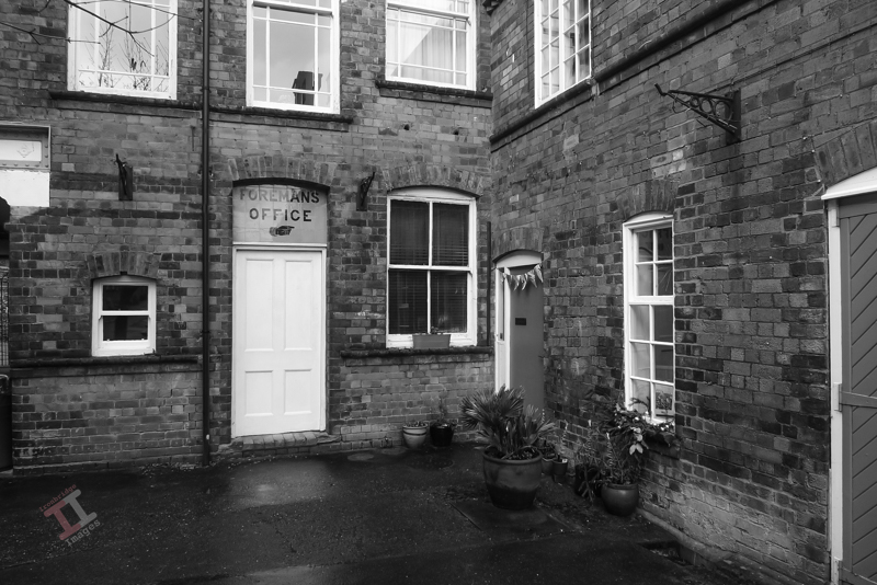
After years of dereliction the courtyard was converted into small workshop units and the upper storeys into apartments. The buildings live again!
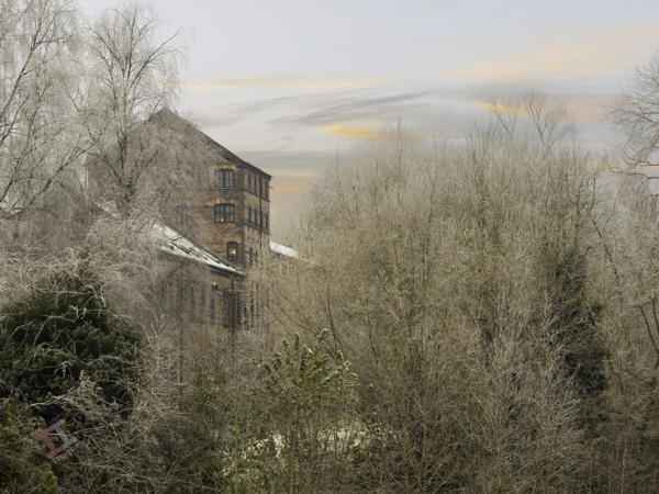
Frosty morning at Maws
Coal chute on Ferry Road
The Great Western Railway played a big part in the evolution of Jackfield, from a fairly squalid river port to a hive of industry. In the next Secret Ironbridge blog post we will visit a lost railway bridge, and its link to another tile works – one that may have helped to destroy part of the village!
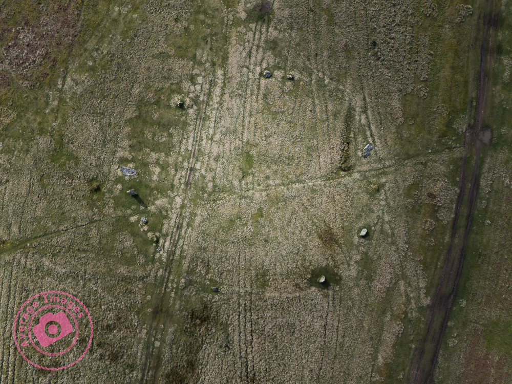
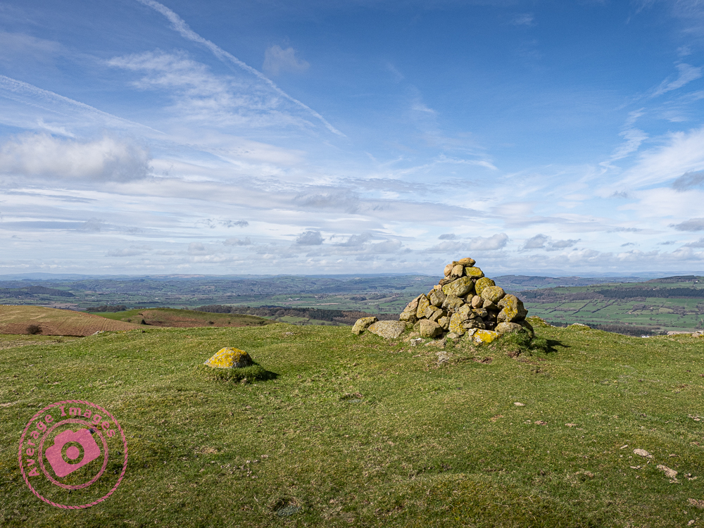
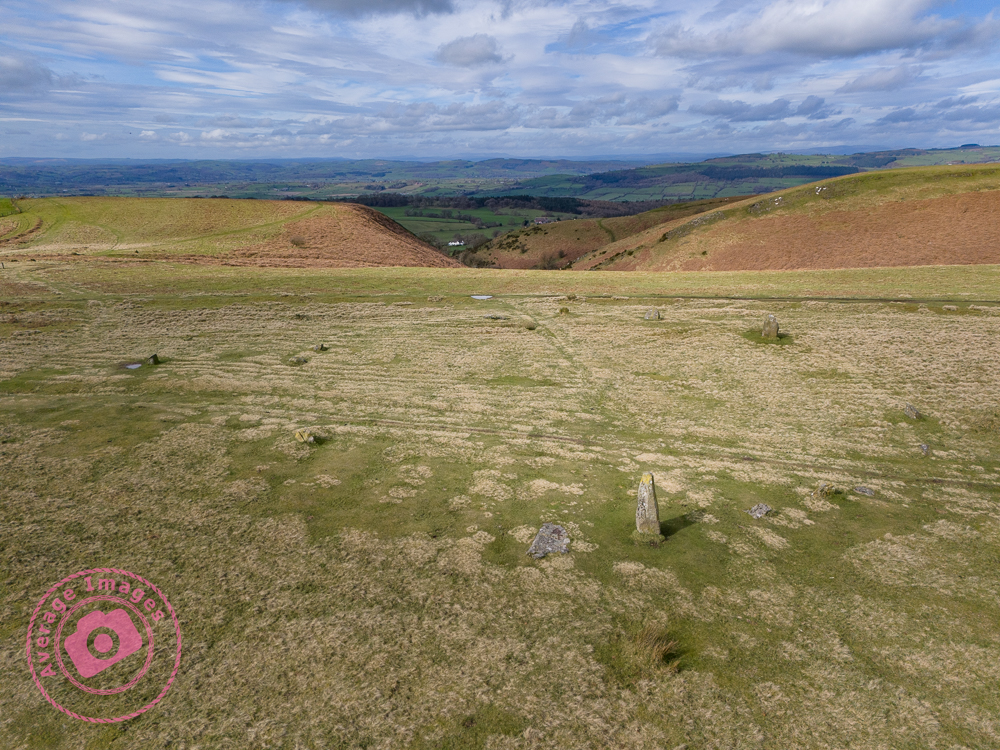
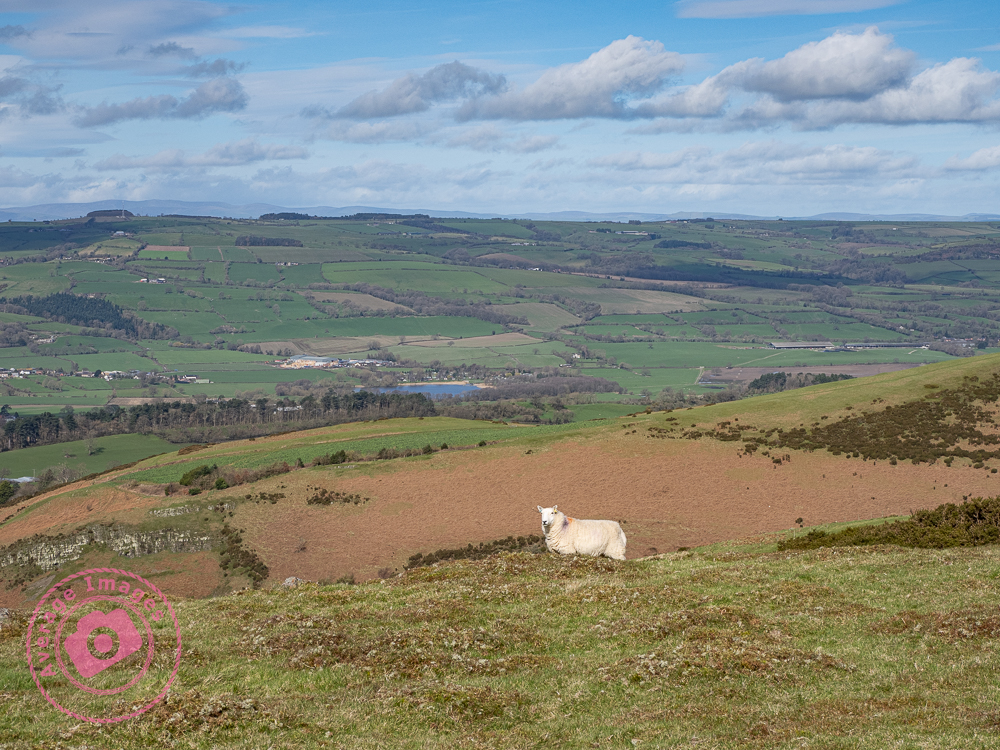
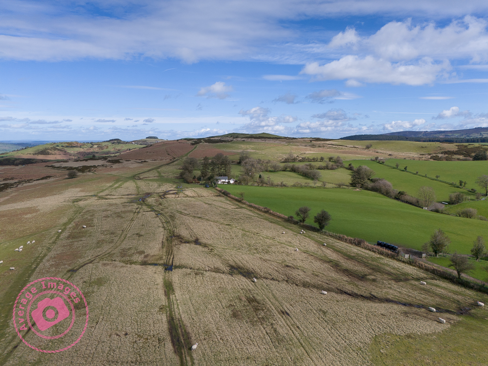
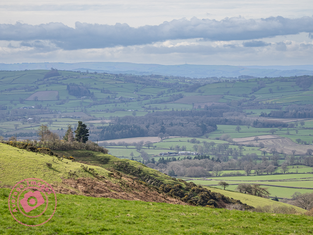
Today is Mrs H’s birthday and so we celebrated by taking the dogs for a walk in the Spring sunshine. We opted to visit the the Mitchell’s Fold stone circle at Stapeley Hill, just over the Welsh border, close to Montgomery. It was a good trek across the moorland, very muddy in places (following the long, wet, Winter) and quite breezy at the top of the hill, but otherwise very pleasant in the warm sunlight.
The stone circle was built in the Bronze Age, about 3,000 years ago. There are fifteen stones (although it is thought that originally there were thirty) but it is unknown exactly why they were built – some think it was for religious reasons, others that it acted as a form of calendar. As stone circles go, the stones themselves are not very big – the largest is about 2 metres high, although the circle itself is 26 metres (about 85 feet) in diameter.
Overhead shot of the stone circle
After a good few hours walking, and a diversion due to an excessively muddy track, we headed home for impromptu washing of our boots – and the car!