Secret Ironbridge: The great fire

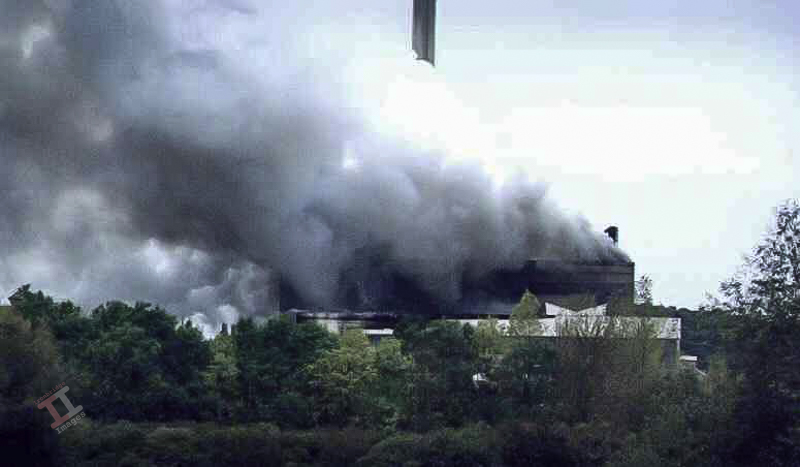
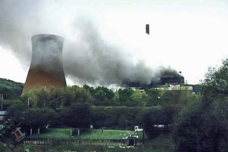
At about 7 o’clock on the morning of Saturday 10th October 1998, the number 2 turbine oil-feed pipe fractured at the Ironbridge power station, starting a major fire.

1998

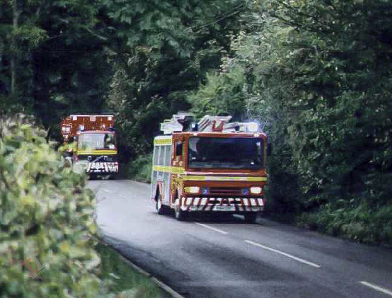
 I was awoken by a distant, but loud wailing noise (which sounded suspiciously like an old wartime air-raid siren), and emergency vehicles speeding past my house. Instinct told me that something big was happening, and so I quickly dressed, grabbed my camera, and headed towards the sound of the siren on my trusty bicycle.

As I reached the Free Bridge I was shocked to see the size of the smoke plume, which was clearly emitting from the area of the power station. It was a strangely eerie sight, made more so whilst accompanied by the relentless wailing siren.

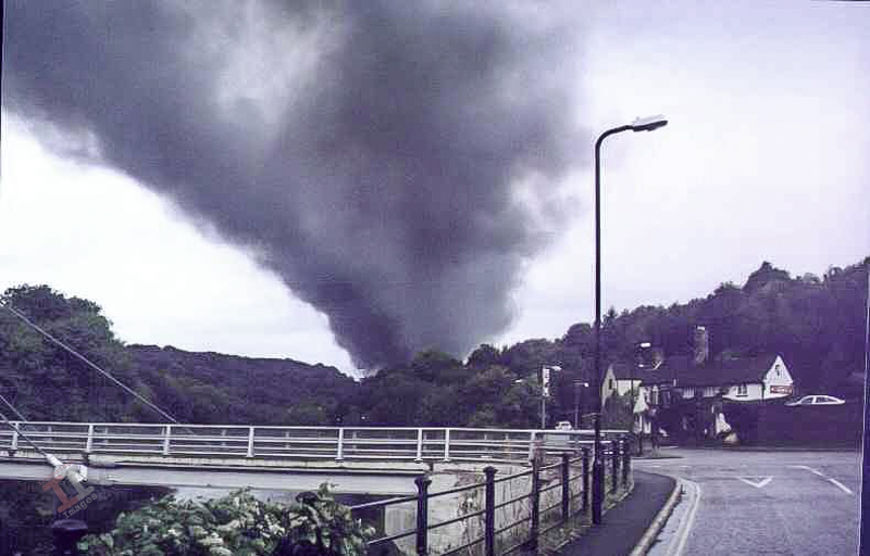
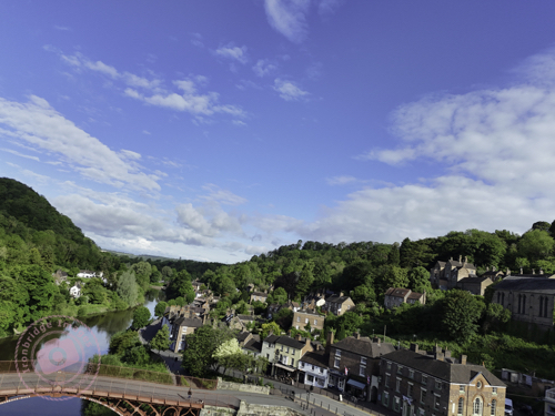
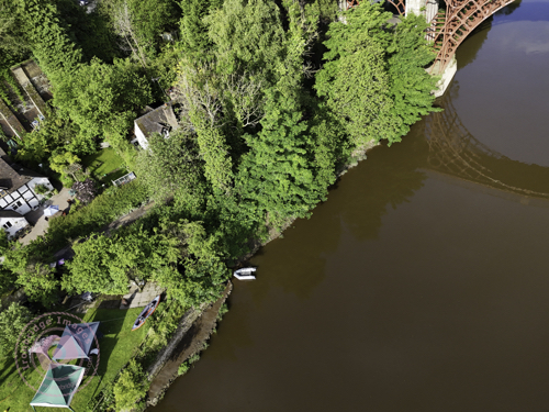
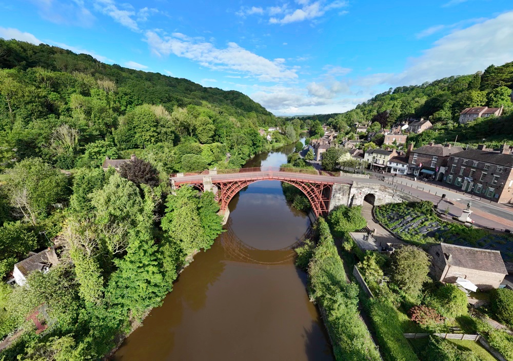
As I cycled through Ironbridge town it occurred to me that my knowledge of the area may help me obtain the best shots, so instead of sticking to the road, I headed through Dale End Park onto the riverside path, which I followed until I was opposite the power station, where I was able to grab the following images.

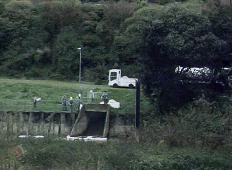
I emerged from the riverside at Buildwas bridge, with the intention of cycling back down the road to Ironbridge. Unfortunately, a rather zealous Policewoman blocked my path and told me that I couldn’t use the roadway because of the smoke risk (the smoke was nowhere near the road) and seemed to take great delight in informing me that I had to cycle up the long & steep Ironbridge bypass in order to get home.

Again, my local knowledge came into play and so after a short ride up the bank I climbed over the fence and joined a small lane that goes from Little Wenlock down to Coalbrookdale. This was fortuitous, as I came across a viewpoint looking directly over the valley at the blazing building, although by now it was starting to look as if it was under control.

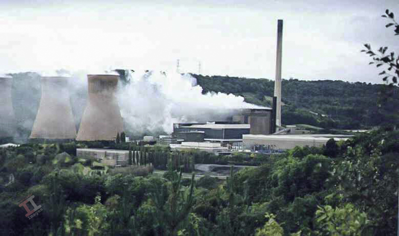
The good news was that no-one was seriously hurt in the fire and, contrary to early reports, the power station was repaired and produced power for the National Grid again, before emission targets meant it had to close down in 2015.

The photographs of the fire from 1998 were taken on a Pentax ME Super film camera and the prints converted into digital files using a scanner.

2010

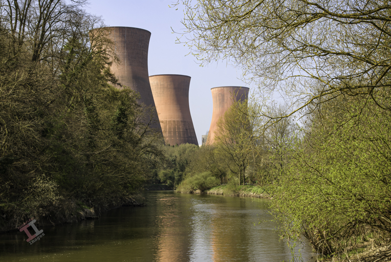
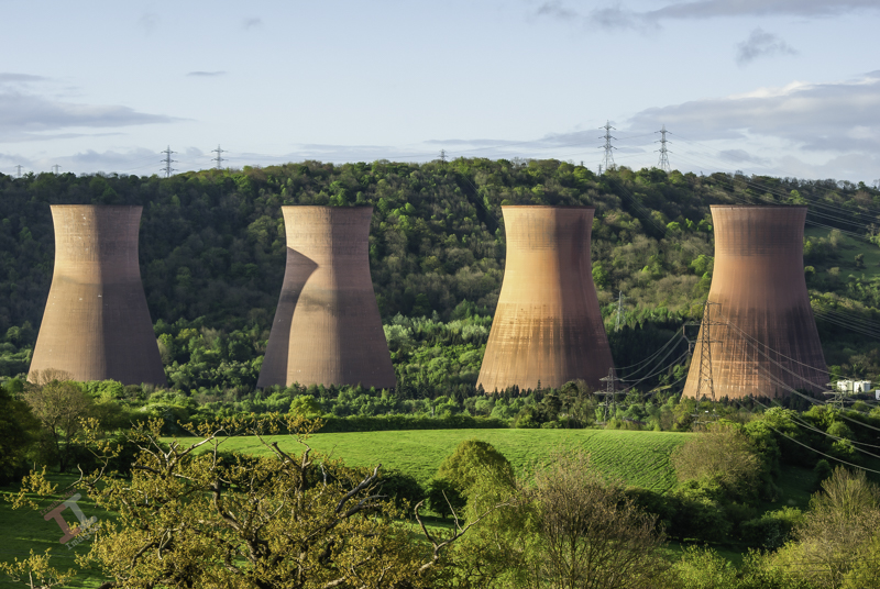
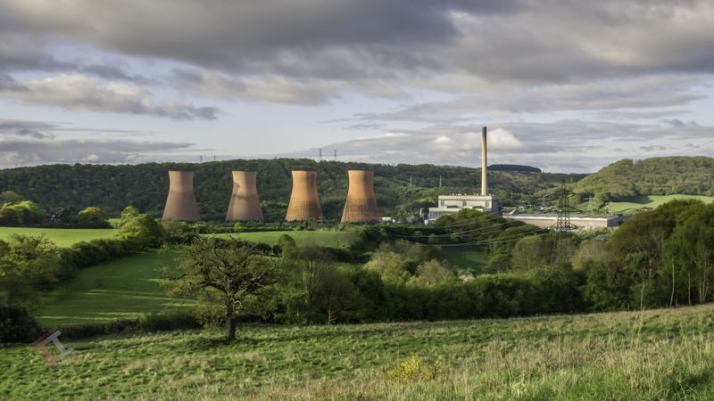
The power station was still dominating the skyline 12 years later:
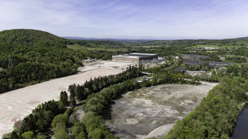
Present-day

Fast-forward to the present-day and the cooling towers are gone; all that remains is a pink pad in the ground. This is all due to be a giant housing estate.

Day-to-night: The office at Craven Dunnill

The office at Craven Dunnill

At first glance, this may appear to be a row of terraced houses, but it is actually a set of Victorian offices inside the Craven Dunnill encaustic tile works in Jackfield, Shropshire.

This was originally taken on a sunny day in May 2009 (remember when we had sunny days in May?), but it was more of a record shot and not particularly inspiring. Therefore, I decided to convert it into a night-time shot using post-processing.

The original shot before the conversion

Firstly, I adjusted the converging verticals. These are usually noticeable in architectural shots because the camera lens is a lot lower than the top of the building, and it gives the appearance that the building is leaning back and/or inwards. Photographers who take a lot of architecture often invest in a ’tilt shift’ lens, which adjusts the perspective in-camera, but post-processing software such as Adobe Lightroom can do it quite easily.

I then needed to remove the very hard shadow created by the building in the bottom-right of the image because this shadow would be out of place in the final image. Whilst I was doing that, I also removed the annoying safety signs on the doors and the dangling electrical cables.

Finally, before carrying out the day-to-night conversion, I replaced the bright blue sky with a more suitable night-time one.

I reduced the exposure of the entire image to give a night-time effect whilst leaving enough light to retain some of the features. I added light to the two lanterns and gave them a slight yellow tint to suggest tungsten light. I also added light to the inside of the nearest room but gave that a slightly bluer tint to differentiate the type of lighting indoors.

Finally, I added incidental light from the open door and windows. This is the most important part of a day-to-night conversion; getting the angles of the light spill and the shadows correct for it to look realistic.

Blast from the past: Ring of poppies

Ring of Poppies

This was taken back in 2009 at a small village called Donnington, near Wroxeter, between Telford and Shrewsbury (and not to be confused with the much larger town of the same name in Telford itself). I can’t remember now whether I knew that this poppy field existed beforehand, or if I came across it by accident, but I can remember trudging around the perimeter of the field with my tripod, trying to find the best composition.

I actually thought at the time that this had naturally occurred, but over the years since, I have never seen another poppy in this field, and so I assume that they had been grown commercially. This explains the poppy-free circle around the tree – presumably they didn’t sow any seeds near the tree because it would take all the nutrients and water from the soil?

Anyway, the red, green and blue are strong primary colours, and so for this reason the photograph stays in my long-term gallery.

Day-to-night: Contemplation

Contemplation

This was a shot taken back in 2019 when I was asked to carry out a photoshoot at the Dinmore Estate in Herefordshire. The lone figure is actually one of the estate workers and was probably just trying to keep warm, rather than contemplating life in general. The image has been post-processed in Adobe Lightroom and Photoshop.

Secret Ironbridge: Hidden viaduct

As the Great Western Railway passes Bowers Yard and heads towards the site of the old power station, it runs very close to the River Severn, and so the Victorian engineers decided that the best solution was to build a viaduct parallel with the river.

A viaduct is a specific type of bridge that consists of a series of arches, piers or columns supporting a long elevated railway or road, typically connecting two points of roughly equal elevation. Contrary to popular belief, if doesn’t necessarily have to be crossing over water. Such is the case here; the viaduct merely elevates the railway above the banks of the river, it doesn’t actually cross it at any point.

It is easy to miss another great feat of Victorian engineering; although you can still traverse the viaduct by foot, the base of it has become surrounded by trees, and ivy clings to the brickwork. Fortunately, my drone was able to fly over the river and catch some shots that otherwise would remain unseen.

There has been some recognition of the viaduct and a lot of ivy has been removed since my shot taken in 2013:

Photograph taken in 2013

Featured Image: Storm over Ironbridge Town

Storm over Ironbridge Town

This image encompasses two of my current projects: it is a day-to-night conversion (including a sky replacement) and a black-and-white conversion. It was taken with my drone, early one morning before the town had started to come to life and post-processed with Adobe Lightroom and Photoshop.

Featured Image: Llanddwyn Island Sunrise

Llanddwyn Island Sunrise

This shot was taken during a 2012 photoshoot tour of Anglesey, in Wales, with good friend & fellow photographer Adrian Evans. We had crossed the Menai suspension bridge and started a clockwise tour of the coastline, and Llanddwyn island (although technically not an island because it is attached to the mainland) is not far, just past Newborough. Access to the ‘island’ is tidal but we had timed our arrival to be able to walk straight across, and we spent a good hour making the most of the light from the early morning sun.

This image above is a bit of a cliche shot, and has been done many times by other photographers – but it remains one of my favourites.

A new header

Yesterday I managed to complete another task off my to-do list; and took a photograph in order to create new headers for my website and Facebook page. The dimensions for both are quite specific (and different to each other) and it required a wide-angle shot so that it could be cropped quite heavily to suit the size and aspect.

I wanted an aerial shot of the Iron Bridge, and so this either meant taking it from a long way off (and then losing detail) or using the panorama function of my DJI Mini 4 Pro drone – the latter turning out to be the ideal choice.

Even though it was 8.30am on a Bank Holiday, it was surprisingly quiet and deserted, and therefore ideal to fly the drone from a seating area directly in front of the bridge. There are four panorama options on the drone; Sphere, 180o, wide-angle, and vertical, but my preferred one, that produces a more natural image without too much stretching of perspective, is the wide-angle – which takes 9 shots in succession and seamlessly stitches them together (within the drones software) to create one large image. You can then output not only the large panorama image, but also the 9 individual shots.

And here is the complete panorama, which I later cropped to produce the headers for my website and Facebook page:

Iron Bridge Panorama

Please don’t forget to visit my new Facebook page and give it a ‘like’. Thanks

Blast from the past: Footpath through the trees

This shot was taken during our Honeymoon in Northumberland back in 2008. After the ‘big day’ we retired to a rented cottage near Amble – our first time in this beautiful county – and I planned photoshoot days with a new camera (a Pentax K200D) that Mrs H had bought me as a wedding gift.

One such shoot was at at Cragside (National Trust) located at Rothbury, near Morpeth – the house and gardens of which were created by an inventor, Lord Armstrong. Within the estate is a Pinetum, a collection of the tallest pine trees in the country, and as we walked down a paved path between the trees, I happened to look back to see the image that I captured below – which looked rather like a tunnel, with sunlight showing in the distance.

Footpath through the trees

Day-to-night: The Malthouse

The Malthouse

In my late teenage years, this was definitely “the place to be” on a Friday and Saturday night for those of us living in the Ironbridge Gorge, probably due to its late-night disco in the upstairs function room.

It was built in 1854, and the large warehouse-type building to the left was indeed, probably a malt house, although the inn was originally called The Talbot (it was still identified as such on the 1925 Ordinance Survey map).

There was a bit of a scare in July 2023 when a freak fire, caused by water leaking into a fusebox, looked as if it may engulf the building. Fortunately the blaze was extinguished before it damaged the structure of the building, but smoke damage meant that it had to shut down for a period. It is now open again.

Secret Ironbridge: Bower yard

Despite being a lesser-known area of Ironbridge, Bower Yard had quite a significant importance: in its history it was the location of a brick & tile works, a ship yard and also substantial lime kilns, some remains of which can still be seen today.

The Iron Bridge from Bower Yard

Note: I have used the modern name Bower Yard, although old maps ofter refer to it as Bowers Yard or even Bowersyard.

Bricks and tiles

Slightly west of the site of Broseley and Iron Bridge Station, and the famous Iron Bridge itself, the Great Western Railway passed under another brick bridge – unusual in that, despite it being a substantial construction, it is very narrow. Analysis of a map from 1883 shows the reason why – it was built solely to carry a small tramway carrying clay from Benthall Edge to the Bower Yard White Brickworks, which lay between the railway line and the river. During its 120 year life, there were several name changes as the site migrated into manufacturing sanitary pipes and stoneware, but it finally closed in 1955.

Ship building

Little is known about the ship building yard, although it must have been a fair size given that there are records of a boat named ‘Sisters’ built at the yard in 1819 which had two masts, weighed 33 tons and was 54 feet (17m) in length, and another named ‘William’, built in 1809, which weighed 70 tons and was 66 feet (20M) in length. Both were subsequently registered at Chepstow, much further down the River Severn, at its estuary with the Bristol Channel.

Lime kilns

The Pattens Rock limestone quarries at nearby Benthall Edge supplied flux for use in the iron smelting industries in the Ironbridge Gorge. This flux was used to remove impurities from the iron stone during the smelting process and required the use of the higher quality limestone. The lower quality limestone was sent to kilns at Bower Yard, which processed it into quicklime, used in construction for mortar, plaster and lime wash, but also in agriculture to reduce the acidity of soil (lime is very alkaline). The kilns purpose was to burn the limestone (calcium carbonate) at about 900 degrees Centigrade to produce calcium oxide (quicklime). This took about 3 days, plus the time to cool the kiln down to extract the lime. The burning of lime gave off particularly noxious fumes which would have made the area a particularly unattractive place.

Lime kiln ruins

The kilns were built during the mid 1800s but their use quickly declined and they ceased to be used by about 1880. Strangely, there was a revival in the 1920s as the demand for limestone increased and they sprung back into life, with significant improvements to their structure, until they closed again in the 1940s. The Great Western Railway played a big part in the success of the lime kilns, bringing coal to them for fuel and lime out of them for sale. There are numerous claims that a railway siding was built specifically for the lime kilns but I can find no evidence on any maps that this was the case.

Also still surviving is the access bridge to the kilns under the Great Western Railway. It’s a narrow bridge, presumably just wide enough for a horse-drawn wagon but the northern flanks are impressively wide and high in order to retain the earth supporting the railway.

In 2011 there was conservation work carried out on the decayed ruins of lime kilns on the Benthall Edge side of the railway, although according to the 1882 OS map, a much more substantial set of lime kilns were located between the railway and the river, opposite the Severn Warehouse.

Severn Warehouse at Ironbridge

Featured Image: Four candles

This image was taken in homage to a classic ‘Two Ronnies’ sketch on their TV show in the 1970’s. The show, by Ronnie Barker and Ronnie Corbett, was a series of comedy sketches during a time before satellite and cable television, and the ‘Four Candles’ sketch was first aired in 1976, when there were just three television channels to choose from; BBC1, BBC 2 and ITV.

Such was the popularity of the show (and the absence of much competition) that the whole family would sit around the television to watch and laugh together. This particular sketch was all the funnier to our family because my parents had a shop, and so did my uncle; which happened to be an ironmongers. I won’t detail the sketch’s premise, but if you haven’t seen it, you can find it on YouTube here.

It obviously created a lasting memory because, some 30+ years later, as I was visiting the Black Country Living Museum, I came across this collection of garden fork handles in a corner and just had to capture them on camera. The bonus was that they were quite photogenic, with their polished handles shining in the golden light from the morning sun.

Four candles

Day-to-night: Beddoes, the old ironmongers

Beddoes, the old ironmongers

I’ll bet that there aren’t very many of us left in the Ironbridge Gorge that remember this building when it was Beddoes, the ironmongers, where you could get anything from four candles to fork handles.

It was established in 1871 by Frank Green Beddoes, and he had this building purpose-built as his shop, with showrooms on the first floor. He also had a large warehouse unit on Waterloo Street, opposite the Police Station; because the business didn’t only exist for domestic customers, they also supplied the many local furnaces, brick & tile works and mines with tools and equipment. It sadly closed in the early 1980s, with its trade sucked away by out-of-town superstores like B&Q. The shop is now one of two estate agents in Ironbridge town.

Secret Ironbridge: Grand Central station?

If you visit Ironbridge by car, you may well follow the signs to Ironbridge Central car park and wonder why it has that name, given that it really isn’t ‘central’ to anything.

This was a name dreamt up by the illustrious Telford & Wrekin Council, but the car park is still known by locals as ‘Station Yard car park’. Why? Because it is on the site of a long-gone railway station on the Great Western Railway (GWR) line.

This entire car park was once a bustling railway station

It was named Broseley and Iron Bridge station on the basis that, at the time it was built in 1862, the majority of the stations passengers came from nearby Broseley, which had a much larger population than around the bridge. During its life the name changed several times (perhaps by grammatical pedants) and was called:

  • Ironbridge and Broseley
  • Iron Bridge and Broseley
  • Iron-Bridge and Broseley

Apart from the single-storey station building adjacent to the bridge, there were two platforms, a a lattice footbridge connecting them, a substantial signal box, numerous sidings and a goods shed. There was also a level crossing (the remains of the track can still be seen) controlling traffic crossing the bridge.

The only remains – railway tracks crossing the bridge approach
A popular postcard of the time shows the signal box, footbridge and level crossing gates.

A map of 1883 shows that, just 20 years after it opened, the station yard was a busy place and subsequent maps show that the layout remained largely unchanged throughout its 101 years life.

The rise in popularity of the motor car (and road transport in general) meant that the railways went into decline after the Second World War and eventually the line closed in 1963. Many blame the infamous Beeching Report for the lines closure but, in reality, its future had already been decided due to lack of use.

Overlooking the Station Yard is the aptly-name Station Hotel (now a restaurant called D’arcy’s at the Station), an imposing Grade II-listed, blue-brick, three-storey building originating at the same time as the railway.

Day-to-night: Last call at Coalport

Last call at Coalport

The public telephone box in Coalport, in the Ironbridge Gorge, shortly before it was removed in 2020. This ‘modern’ version had previously replaced a traditional red telephone box, one in which I made many calls before my parents had a telephone line installed (yes, there was life before mobile phones). I can even remember the original public telephone that used pre-decimal coins, and had an ‘A’ and ‘B’ button that determined if you were going to connect to the call (and let the box have your money) or terminate the call (and have your money back). It was a stressful time when you were down to your last penny coin!